
This blog uses affiliate links. If you’d like to purchase a recommended product, please use the link to support this blog. It doesn’t cost you anything extra, it simply allows me to continue creating these posts. Thank you so much for your love and support!

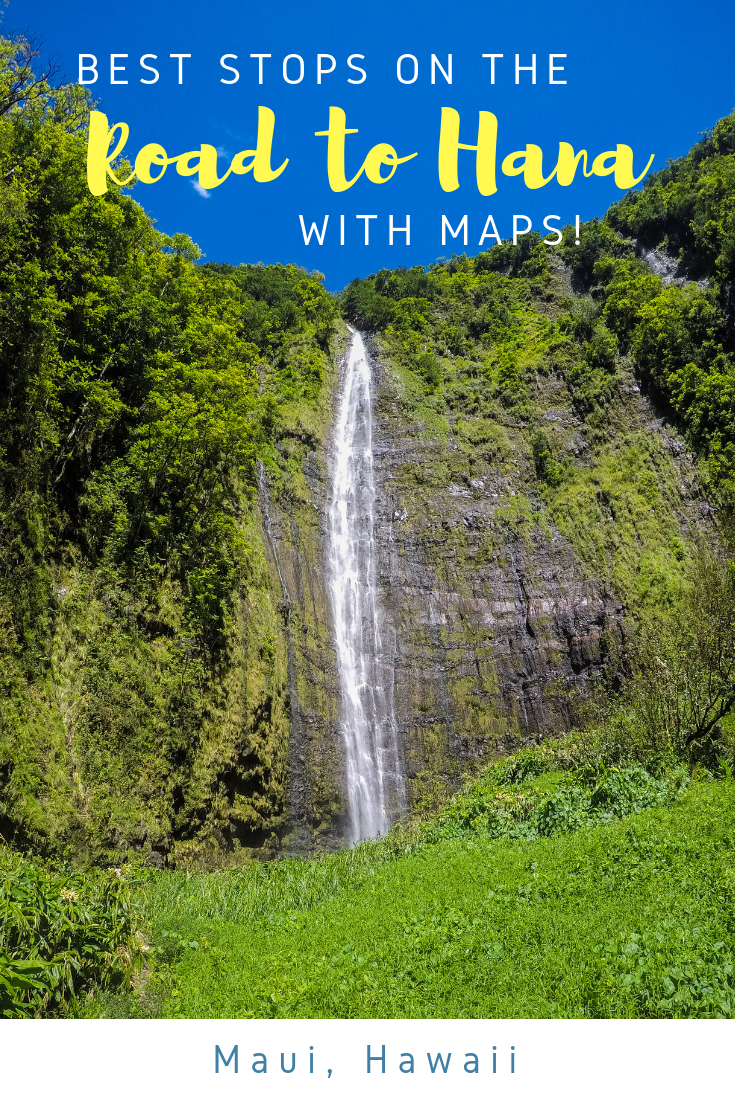
Road to Hana Best Stops (2026): Must-See Mile Markers + Map & Honest Tips
Planning the Road to Hana? 🌴 This 2026 guide shares the best stops on the Road to Hana, a helpful map, how long the drive really takes, safety tips, what to avoid, and advice for visiting with kids. Perfect for first-time Maui visitors planning a stress-free day trip. Save this for your Hawaii trip planning!

Kahanu Garden - National Tropical Botanical Garden
Best Stops on the Road to Hana (2026 Guide + Map & Real Tips)
UPDATED May 4, 2026
The Road to Hana is one of Maui’s most iconic drives — and also one of the most overwhelming to plan. With over 600 curves, dozens of waterfalls, and endless pull-offs, it’s impossible to stop everywhere in one day.
This guide breaks down the best Road to Hana stops that are actually worth it, based on driving the route multiple times. We’ll cover must-see stops, how long the drive really takes, whether it’s worth it, tips for families, and include a map so you can plan without feeling rushed or overwhelmed.
🧳 Before you go, check out everything you need to pack for Hawaii here: Packing Checklist for Hawaii 🧳
Road to Hana Quick Facts
- ⏱ Time Needed: 8–12 hours round trip
- 🚗 Distance: ~64 miles round trip
- 🛣 Curves: 600+
- 🌉 Bridges: 50+
- 👶 Kid-Friendly? Yes (with planning)
- 🚙 Rental Car OK? Yes
- 🗓 Best Start Time: Before 7am

One of our favorite things to do in Maui is to drive the Road to Hana. The road, also known as Hana Highway, stretches around the north to the east coast of Maui, entering through the town of Paia. Stops vary from hiking to waterfalls to gorgeous breathtaking views. You'll even learn some Hawaiian history! Before you head out for your day of fun, this guide will help you map out your stops, provide some Pro Tips, and give you a sense of what to expect for the day. EVERYTHING you’ll need to know is right here!
See our detailed ROAD TO HANA post for more information as to how valuable this guide is!
📗 Don’t forget to download our ROAD TO HANA COMPLETE GUIDE with map for 23+ stops!
It is filled with more information on popular stops including pro tips on what to do while you’re there, parking tips, and awesome food stops! It’s your guide to a perfect day along the Road to Hana!
By purchasing, you’re helping support the blog with the time and effort put into these posts. 😉
Before you Begin - Directions to Road to Hana Map
Download our ROAD TO HANA COMPLETE GUIDE or something you can access Road to Hana stops offline. Cell reception can be spotty, especially when you're looking for that waterfall you've been dying to see. Make sure you save the guide to an offline source like the "Books" app on your iPhone.
🗺️ Here is a Road to Hana map that coincides with all stops listed below that you can turn on, and save to your Google Maps app:
Prior to your departure, map out about 6 stops for the day. We have more stops below as we’ve done this drive multiple times, but you can't do all of these in one day.
✨PRO TIP: On your flight to Hawaii is a GREAT time to make your Road to Hana plan! Download our ROAD TO HANA COMPLETE GUIDE PDF prior to your flight to your computer, tablet, or smartphone in an offline app!
How long does it take to drive the Road to Hana?
That’s a loaded question, it takes about 3 hours to drive the Road to Hana Highway get to Hana Town from Kaanapali or Wailea. It’s then up to you how long you want to spend at stops and how far you want to travel.
The Best Road to Hana Stops (If You Only Have One Day)
If this is your first time driving the Road to Hana, these are the stops that give you the best experience without rushing or burnout:
Coconut Glen's ice cream (15 mins)
Lava Tubes (30 mins)
Black Sand Beach (30-60 mins) - YOU MUST MAKE A RESERVATION
Red Sand Beach - Koki Beach (30 mins)
Haleakala National Park (2 hours - if you do the long hike)
Make sure you bring water (especially for the hike) and snacks for the car. Go for a swim! Don't forget to bring other necessities for the day - download our ROAD TO HANA COMPLETE GUIDE which includes a complete PACKING LIST.
Start early and come back before dark, the roads aren't well lit at night. Jeeps are the best for driving some of these trails. Get a great deal on rental cars with Booking.com.
To drive the Road to Hana you can go 2 ways:
Normal Way - Take highway 365 to 360 and start clockwise on the Northside.
Back Way - Head south on Highway 37 and come up counterclockwise to the Northside.
Total drive time is about 6 hours driving to the furthest point (Haleakala National Park) and back without stopping. Be careful on the turns, as some of them go down to one lane. Of course, with so many amazing stops and fabulous views, it doesn't seem that long!
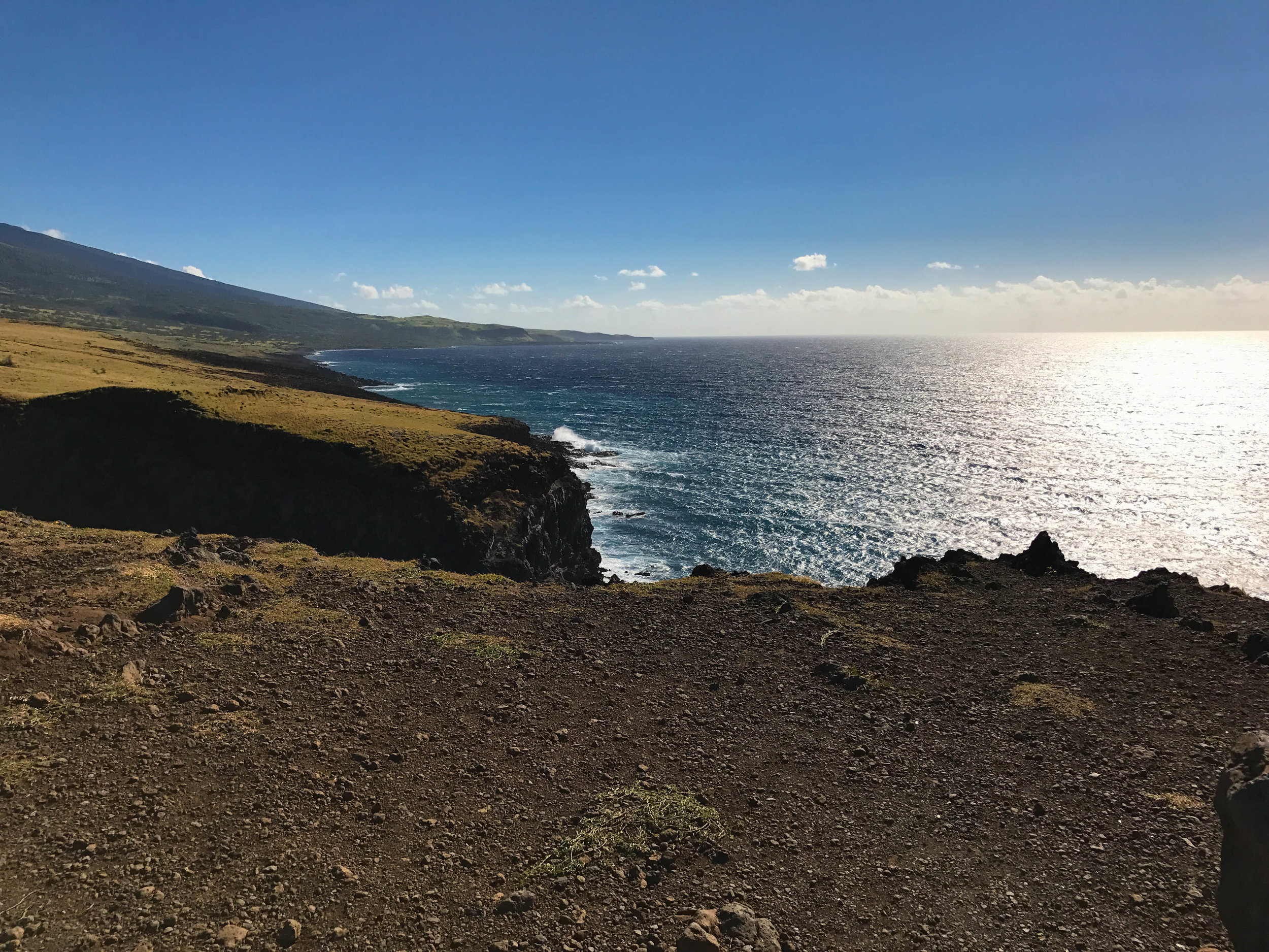
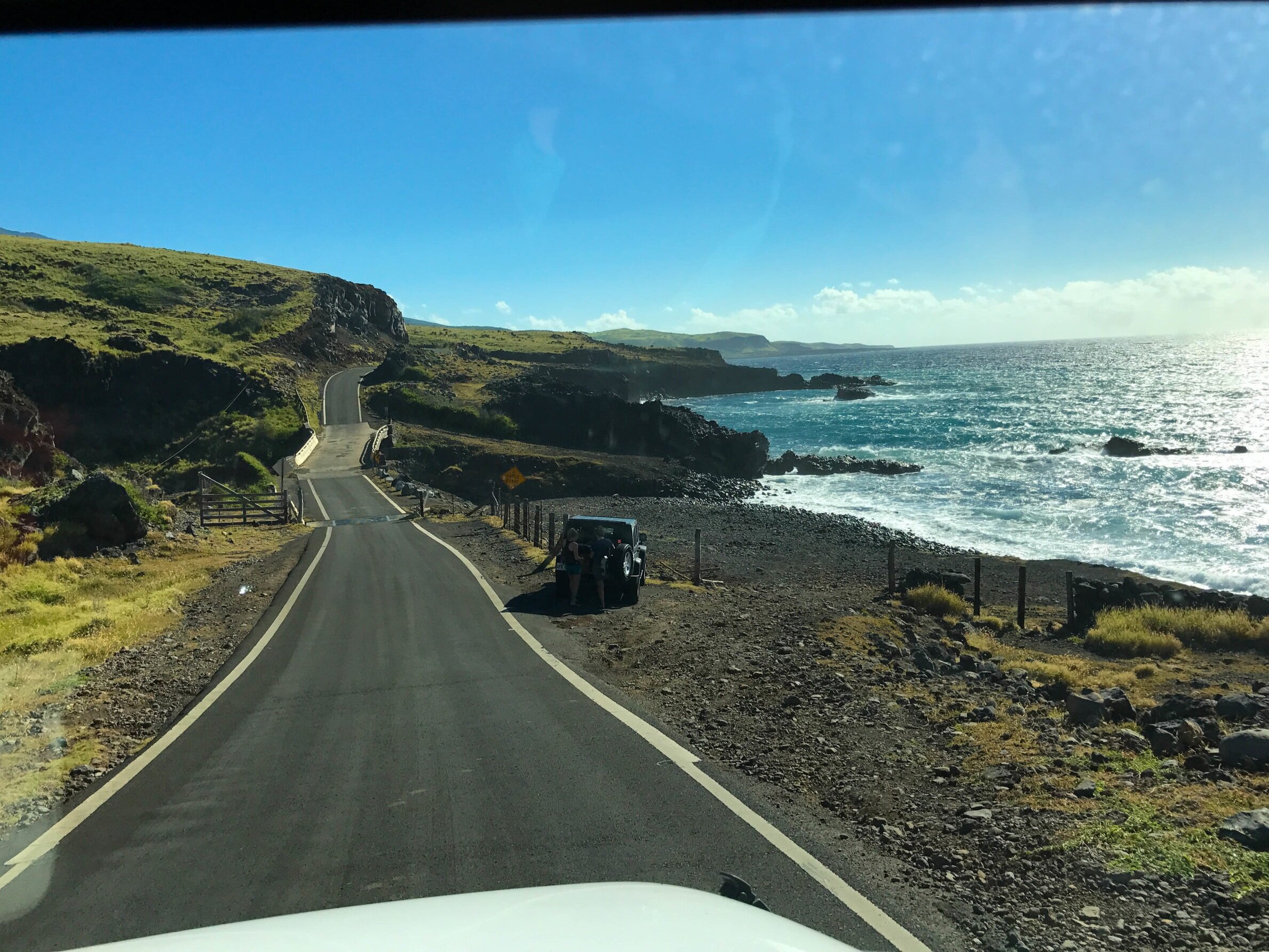
We've driven around Hana both ways. The rental car companies advise you not to come "the back way" to prevent wear and tear on the unpaved, rocky, jagged roads. Here’s what the back way to Hana looks like (before it gets extremely bumpy for 20+ minutes):
Know Before You Go: 2026 Updates
Make sure you make a reservation before going to the Black Sand Beach. I would hate for you to be turned away from Waianapanapa State Park
It rains more often on Hana Highway, make sure you check the latest weather predictions and Road Closures - before you head out.
If you don't feel like driving (I don’t blame you), check out this amazing Road to Hana Tour with Activity Authority recommended by a local!
I also used these sites to guide us along the highway:
Maui Guide - Beautiful photos and great info for all stops on the Road to Hana
MAUI GUIDE BOOK - great info for Hana, and all things Maui
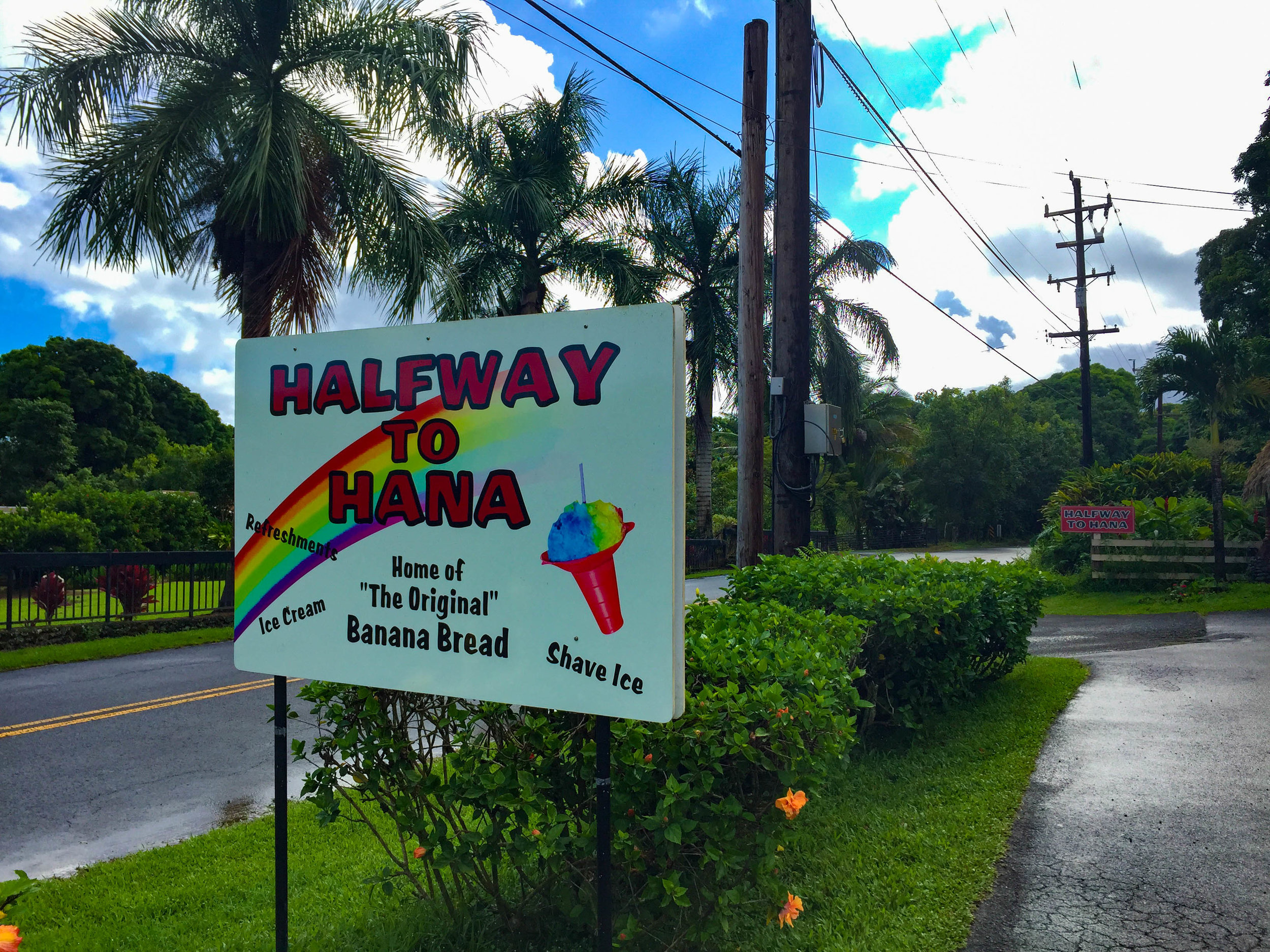
FIRST STOP: HALFWAY TO HANA Best Banana Bread Road to Hana Maui
If you travel the traditional clockwise way, your first stop should be the Halfway to Hana stand and stop for the banana bread - it's amazing, and perfect for breakfast! Try their shave ice on your way back, but no judgment if you have it first thing In the morning!

See all MAUI Posts or these RELATED POSTS:
🗺️ Check out our ULTIMATE MAUI TRAVEL GUIDE including where to stay, what to do and best restaurants!
🍔 Don’t miss the Best Restaurants in Maui
🌊 See our favorite Top 10 Things to do in Maui
BEST SIGHTS TO SEE ON THE ROAD TO HANA HIGHWAY TOUR:
Our favorite stops to visit on our Hana Highway tours involve fun, patience, adventure, and you might get a little wet!
Is the Road to Hana Worth It?
✔️ Yes, the Road to Hana is worth it if you enjoy waterfalls, lush scenery, and slow travel
❌ No, if you hate long drives or tight roads
✔️ Worth it for first-timers who start early
❌ Not ideal if you’re short on time or prone to motion sickness
The numbers and sights below are in order traveling clockwise representing the mile marker on the Road to Hana (there are markers you'll see along the side of the road).
Mile Marker #2 Twin Falls
Park in the lot and you can hike down to the falls. If you keep to the left split you'll find Ho’olawa li’ili’i; if you head up to the top, there is another waterfall Ho’olawa nui.

Twin Falls stop on Road to Hana
The Twin Falls have split waterfalls that feed into a pool. Many people love to swim here during the day, but beware - the water is pretty cold! Although it does feel nice on a warm day!
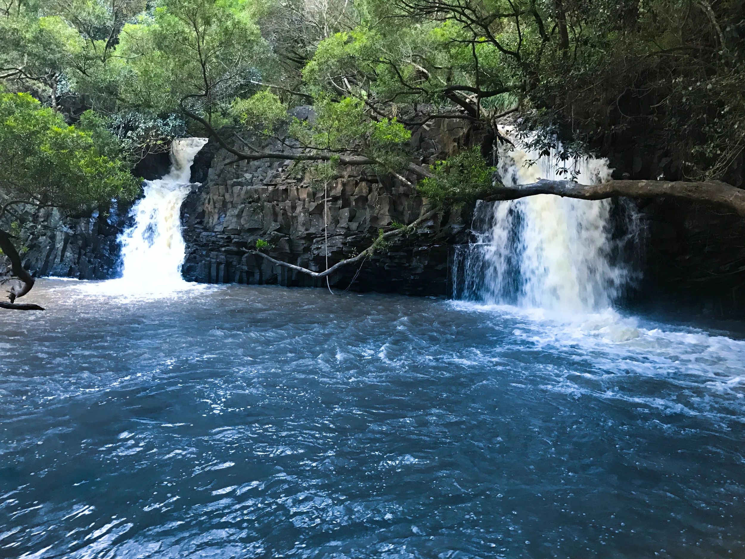
Twin Falls with rope swing on Road to Hana
🚘 Parking: Lot available but fills up quickly with tour buses, or you can park along the road. Make sure you turn in your mirrors; those roads are narrow and we've seen them get knocked off! Don't let it happen to you. They also have a snack stand and porta-potties.

Rainbow Eucalyptus
Mile Marker #7 Rainbow Eucalyptus Trees
The largest grove of rainbow eucalyptus trees can be found near mile marker 7. No need to stop as they can be seen along the highway. I just love these trees with streaks of beautiful colors are scattered throughout the drive, and prominent at the Ke’anae Arboretum as well as areas right before Hana town.
What is a rainbow eucalyptus?
Per Wikipedia: Patches of outer bark are shed annually at different times, showing a bright green inner bark. This darkens and matures to give blue, purple, orange, and then maroon tones. The previous season’s bark peels off in strips to reveal a brightly colored new bark below. The peeling process results in vertical streaks of red, orange, green, blue, and gray.
Mile Marker #19 Upper Waikani Falls AKA 3 Bear Falls

3 Bears Falls also known as Upper Waikani Falls at mile marker 19
You can see Upper Waikani Falls also known as 3 Bear Falls from driving along the road (pictured above). It looks like a papa bear, mama bear, and baby bear stream! HOWEVER, there are so many waterfalls, I don't think this one is worthy of an actual stop, just look out your window around mile marker 19!
🚘 Parking: If you do plan on stopping, there are spots to pull over on the side of the road.
My favorite stop: Mile Marker #27 1/2 Coconut Glen’s Ice Cream
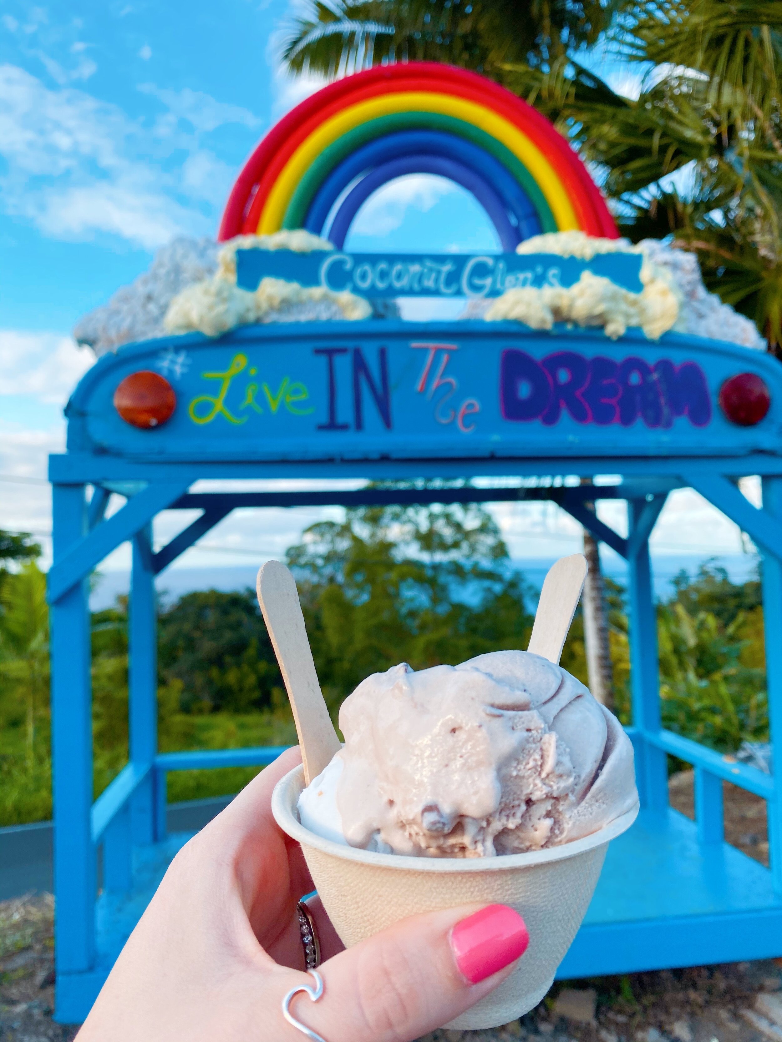
Coconut GLen’s Ice Cream
Organic, vegan ice cream made with coconut milk from coconuts found in the jungles of Maui. I was skeptical of the words "vegan" and "coconut milk," but it was quite delicious. Also, they serve their ice cream in coconut shells! We went there on our way back to the hotel; just note their hours when you go.
🍦Check out our full review here: ICE CREAM REVIEW: Coconut Glen’s Ice Cream 🍦
🚘 Parking: Has a parking lot with a turtle. Look closely under the shrubs.
Why we always stop at Mile Marker #29 Nahiku Marketplace
Nahiku Marketplace (located at 1546 HI-360, Hana, HI 96713) is also close by, and is a great place to stop for coconut shrimp, fresh fruit, smoothies, or Hawaiian mixed plates! We LOVE grabbing lunch (like a picnic) at the food trucks and taking it to a beach or waterfall to enjoy.
While waiting for your tacos at Da Fish Shack, it's the perfect time to pull out our Truck Hero Scavenger Hunt to keep the kids entertained!
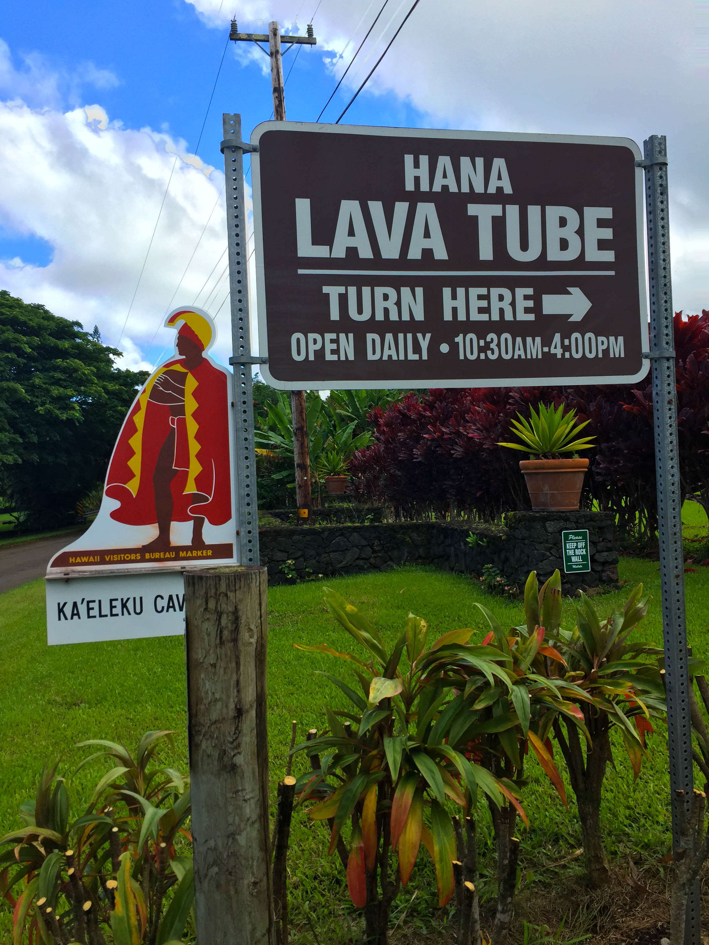
Literary Hawaiian Culture Stop: Mile Marker #31 Lava Tubes or Ka'leleku Cave
Just past mile marker 31, turn left onto Ulaino Road. Drive 0.4 miles to the “Hana Lava Tube” visitor center entrance. The entry fee was $12 a few years ago. It may have gone up (cash only), which provides a quick overview and history as well as a map and a flashlight to explore.
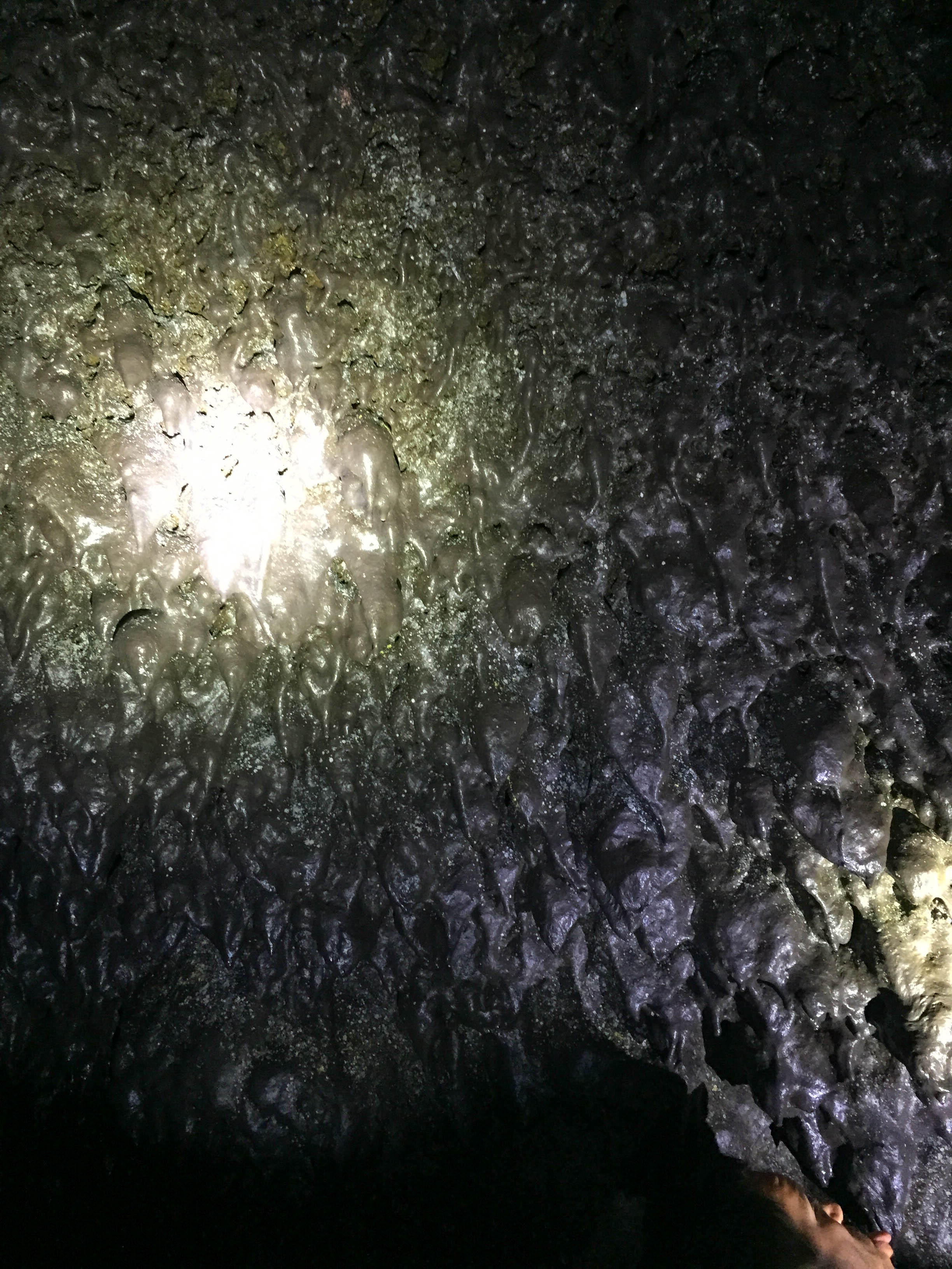
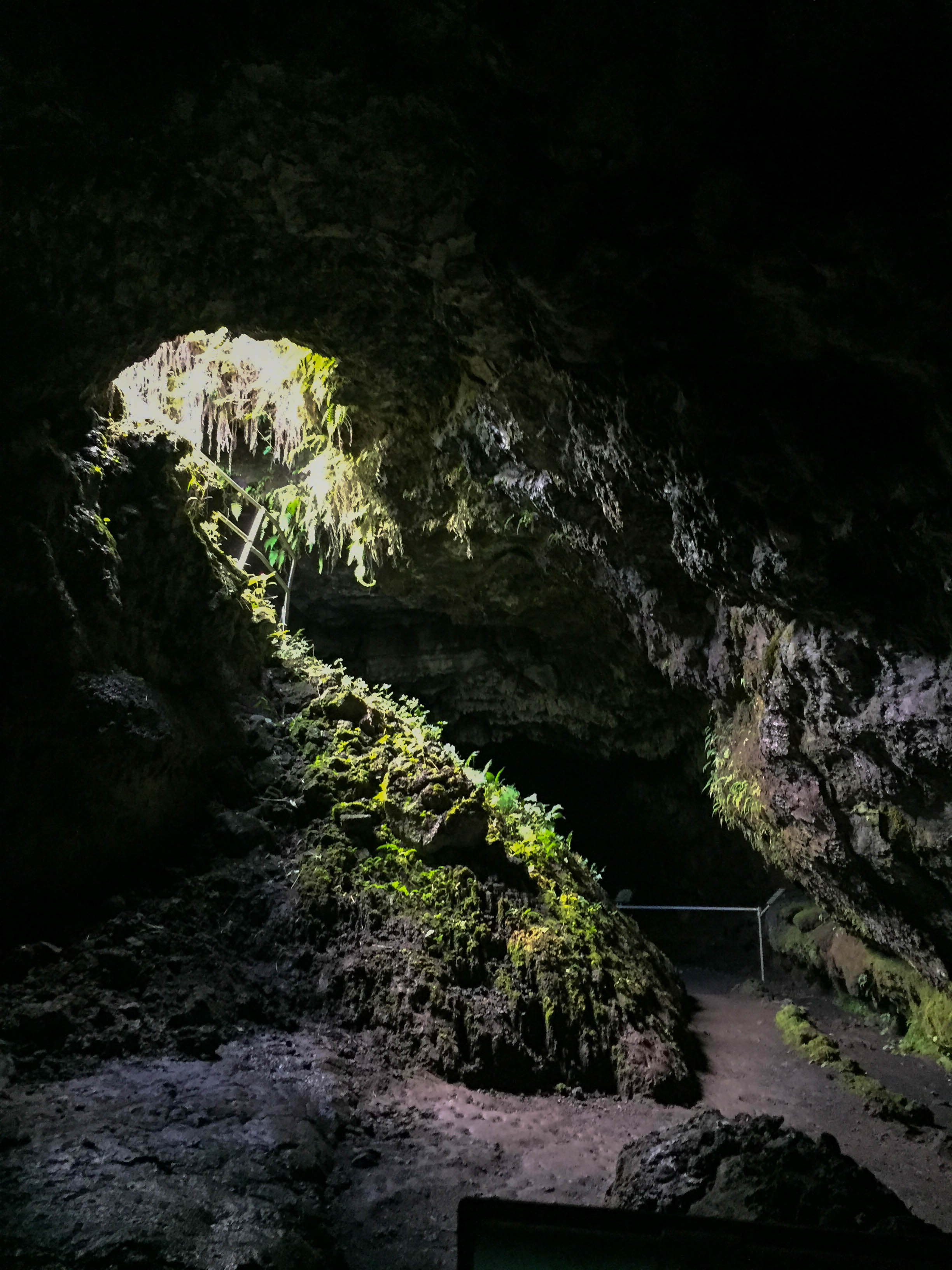
The Lava Tube is about 1/3 mile long and was formed when massive lava flows cooled off on the surface, creating an insulating conduit with lava flowing underneath. During eruptions, the cave served as a channel for the lava to travel along underground until it reached the ocean. In the tubes, you will find lavacicles, stalactites, and a few skylights along the way. We spent about 30 minutes getting to the end and back. Above ground, there is a maze full of ti plants (a maroon color). Good luck!
🚘 Parking: There is a parking lot!
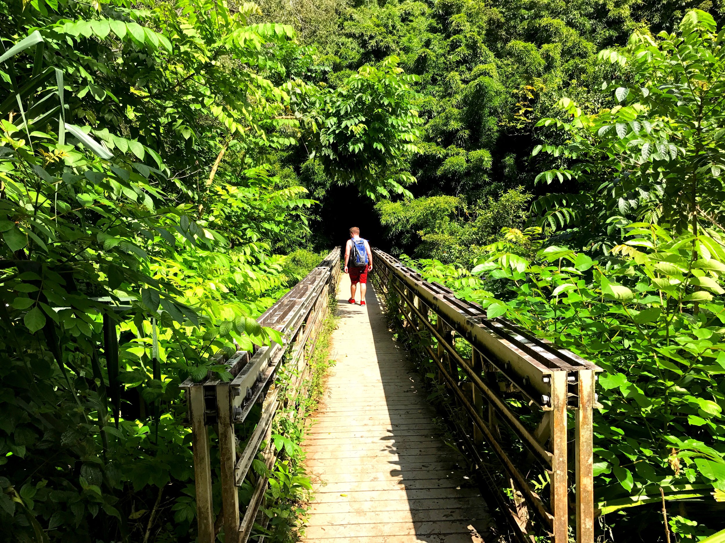
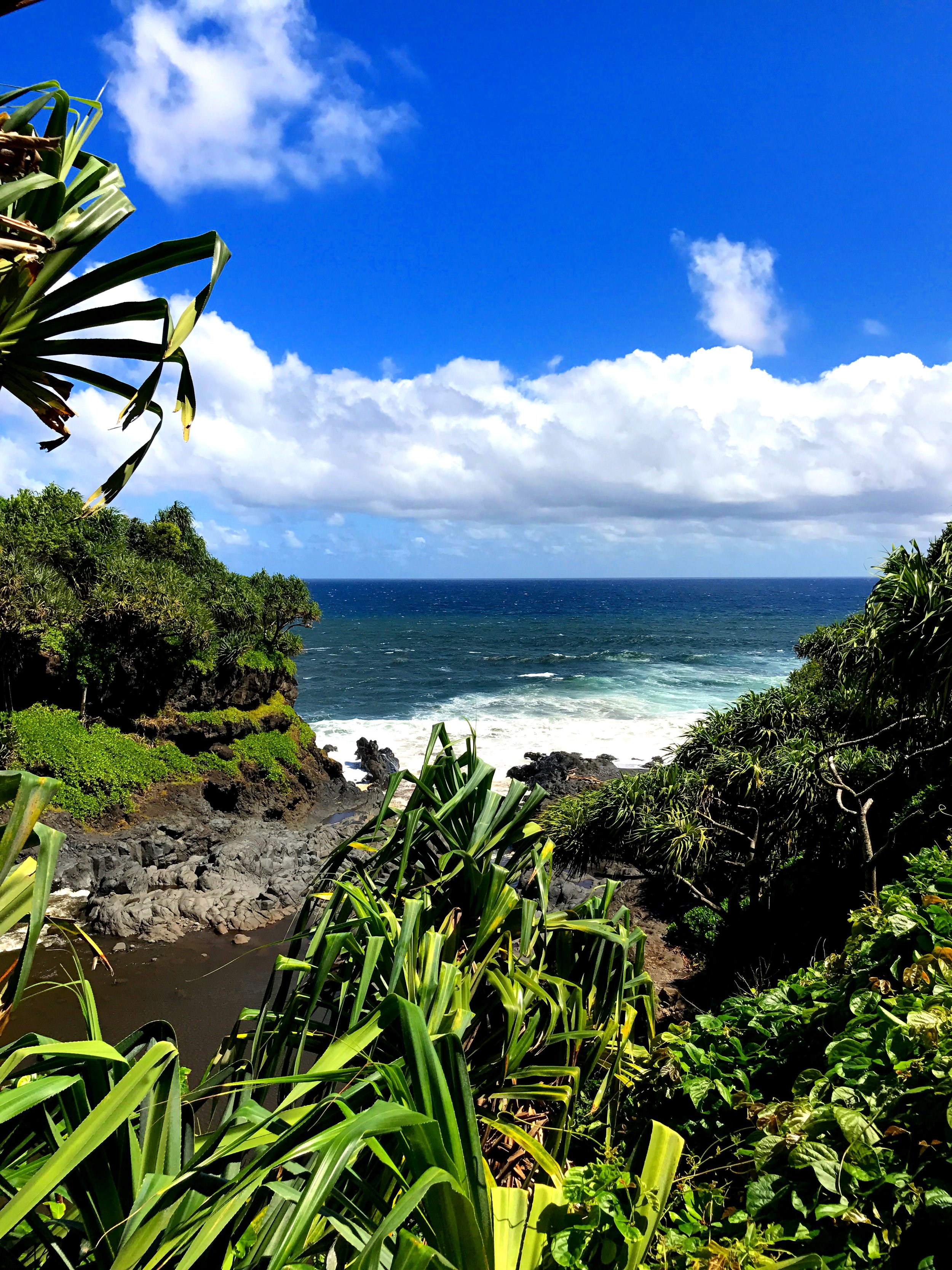
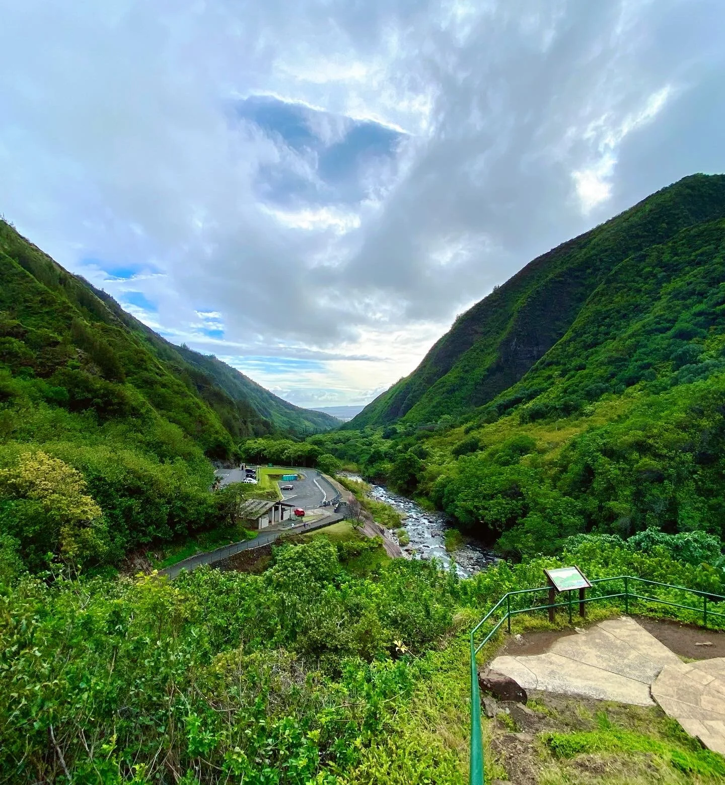
Beautiful Views: Mile Marker #31 Kahanu Garden - National Tropical Botanical Garden
Address: 650 Ulaino Rd Hana, HI
Just down the street from the Lava Tubes, lives a lush botanical garden with waterfalls & gorgeous coastal views.
Per their website: Plant collections from the Pacific Islands are the focus here, particularly plants of value to the Hawaiian people as well as other cultures of Polynesia, Micronesia, and Melanesia. Kahanu Garden is situated in the storied land of Honoma'ele and home to Pi'ilanihale Heiau, a massive lava-rock structure that is believed to be the largest ancient man-made structure in Polynesia.
You can take a guided tour or just wander around (which we did for about 30-45 minutes). Tour info per their website:
Tour Duration: 2 hours
Check day and operating hours on their website
Ticket Prices for a guided tour: Adults (13 and older) - $30 | Children (12 and younger) - free*
Ticket Prices for self-tour: Adults (18 and older) – $12 | Kamaaina – $7 |Teen (17-13) – $5 | Children (12 and younger) – free | Hana Residents – free*
*ticket prices are subject to change. Make sure you check their website for the latest info!
Pro Tip: Just past the twin falls there is the Garden of Eden Arboretum (10600 Hana Hwy, Haiku, HI 96708), but the views are better at Kahanu Garden.
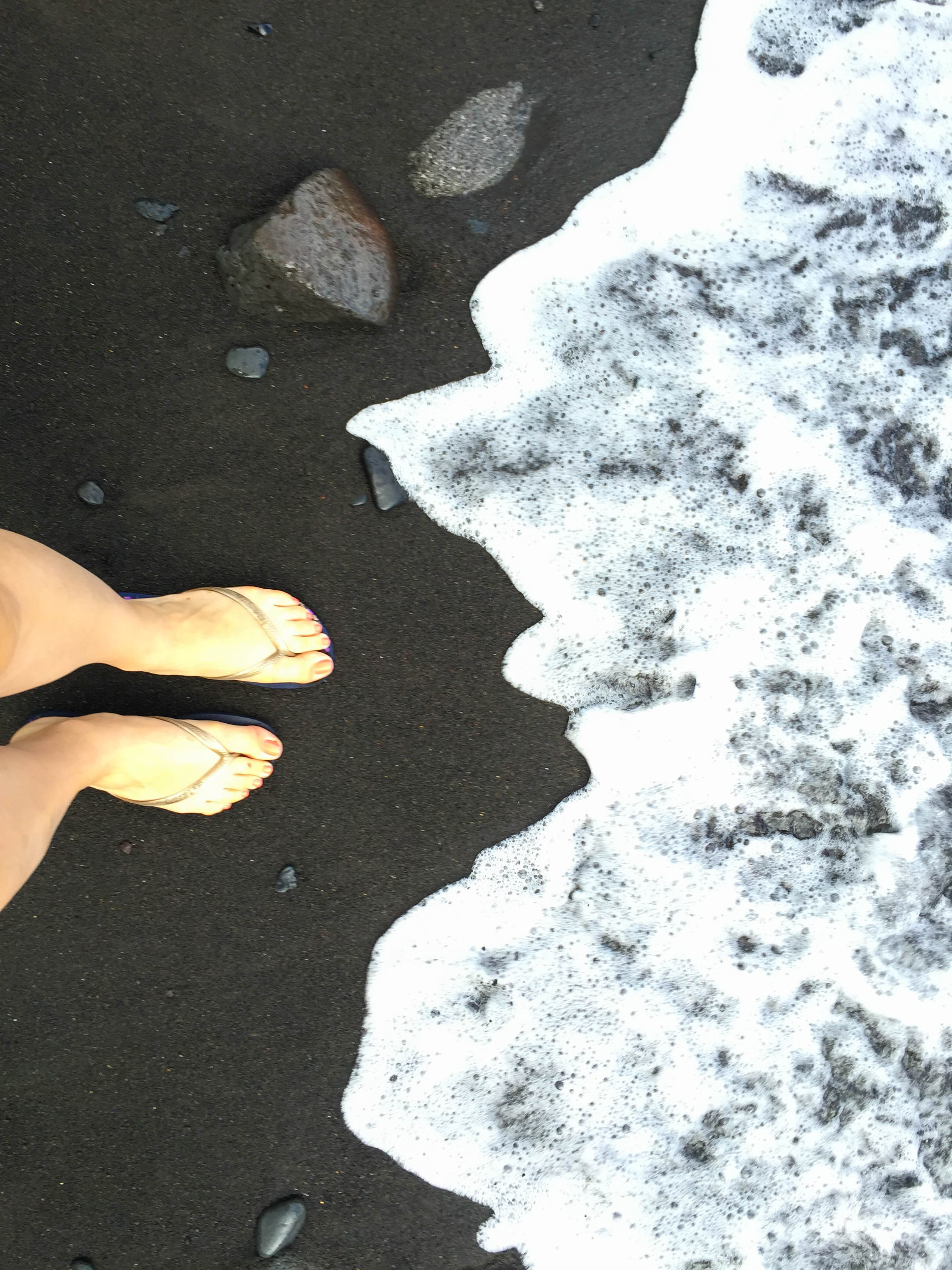
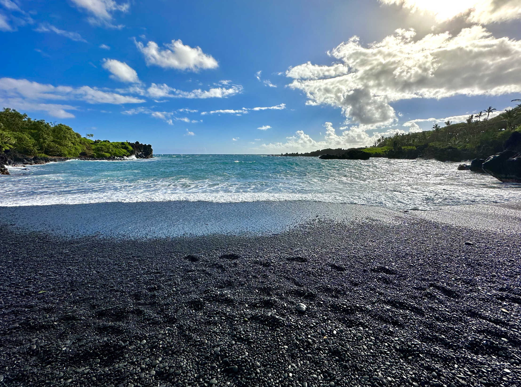
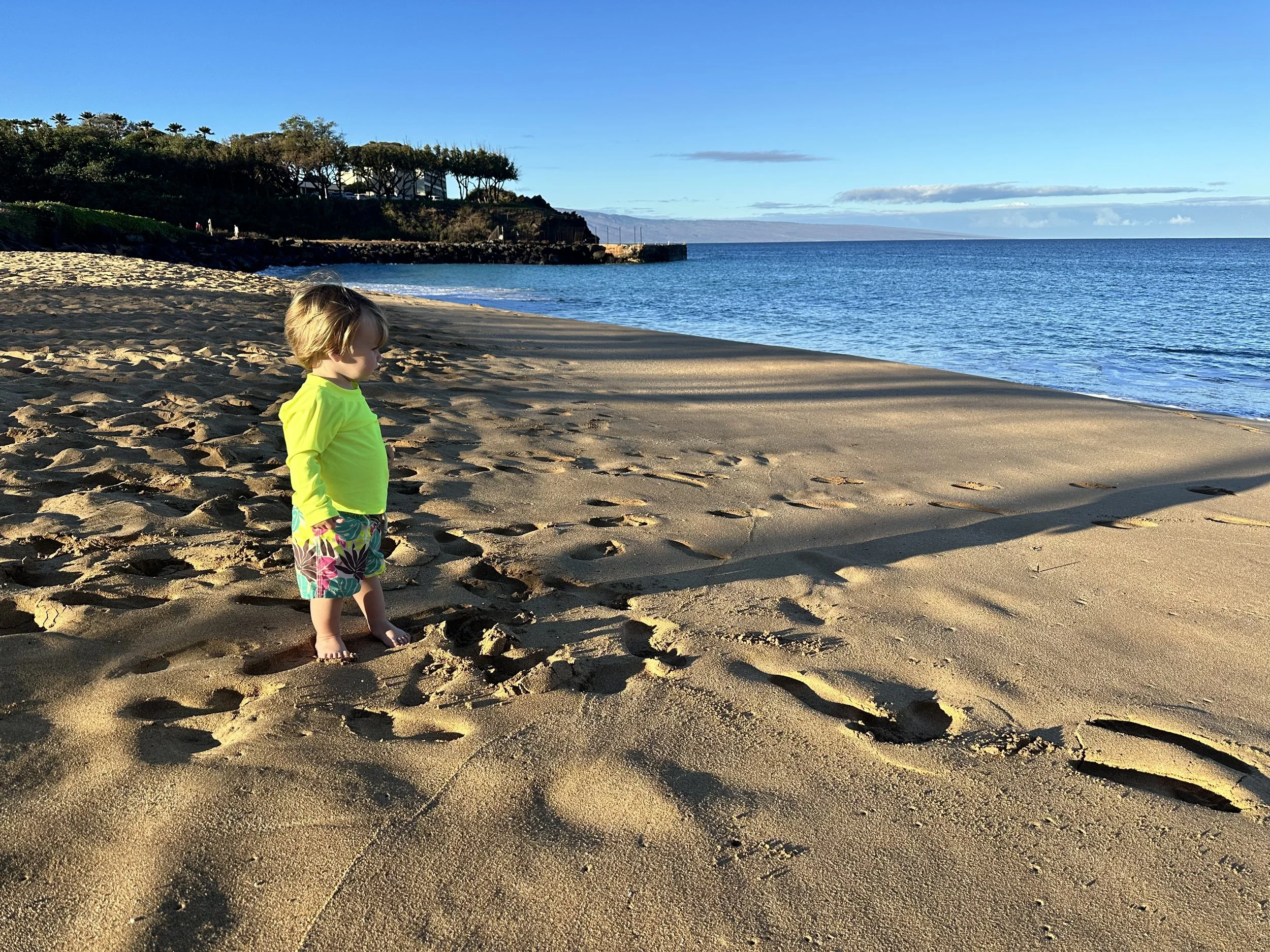
#32 Waianapanapa State Wayside Park - Black Sand Beach (MY FAVORITE STOP and best stop for families!)
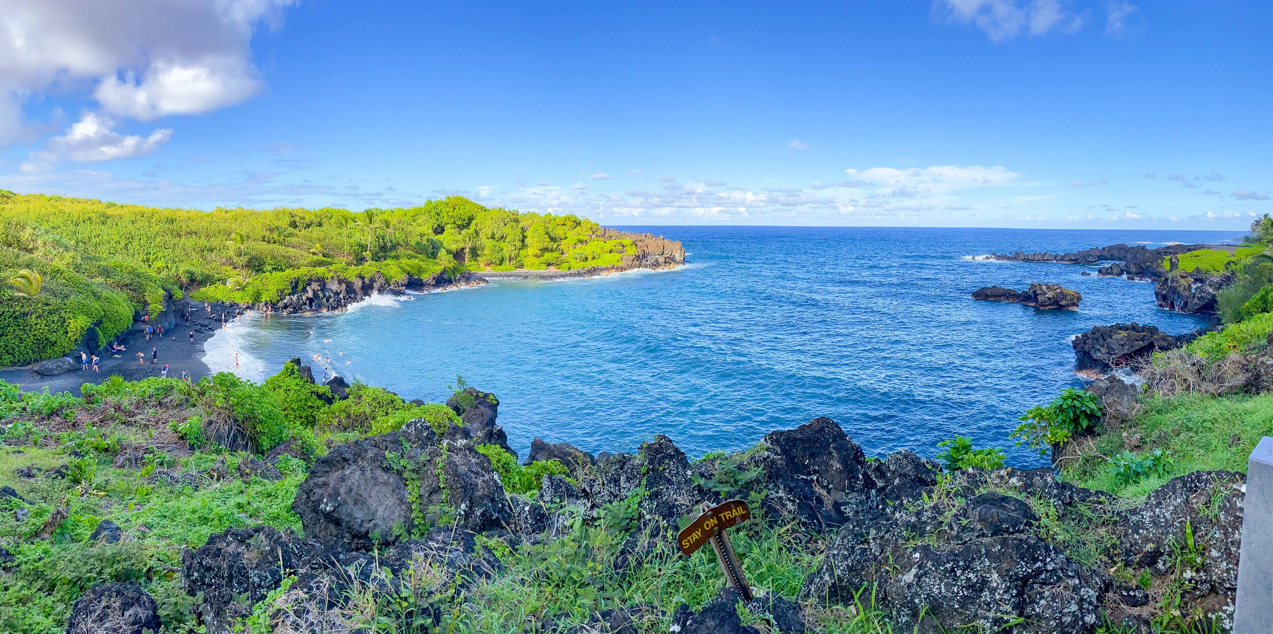
Black Sand Beach views
This is the main black sand beach with a few sea caves to explore. It’s really different to see the black sand between your toes! According to Skylinehawaii.com, a common way that black sand and black sand beaches are formed is when hot lava hits the cold ocean water and cools very quickly, causing it to shatter and break into pieces of basalt fragments of all sizes-- including grains of black sand.
There are a couple of paths that you can get a little hike and take a moment to stretch your legs! You can even bring food and eat at the picnic tables. Camping is available here if you’re into that!
This was the best stop that we took our toddler to! We were able to walk down to the beach and play in the waves.
NEW: All visitors and commercial operators will need to make reservations to enter the popular Waiʻānapana State Park on Maui, beginning on March 1, 2022. Make your reservation HERE. There are 2-3 hour blocks including an entrance fee per person and parking fee per vehicle:
Entrance Fee
Hawaii Residents = Free w/ Drivers Lic. or ID
Non-Residents = $5.00 Per Person
Children 3 and Under = Free
Parking Fees
Non-Commercial Vehicles
Residents = Free w/Hawaii ID or Drivers Lic.
Non-Residents = $10 per vehicle
Commercial PUC Vehicles
1-7 passenger vehicles: $25
8-25 passenger vehicles: $50
26+ passenger vehicles:$90
🚘 Parking: There is a parking lot as well as public bathrooms!

Hana Town
Hana Town stretches for a few miles and here are a few sites you can't miss!
Picture perfect beach we never miss: Mile Marker #50 Hamoa Beach

Hamoa Beach
One of Hawaii's most spectacular beaches hidden on the beautiful Koki Peninsula. Perfect for a refreshing swim or working on your tan on the shore.
🚘 Parking and Directions: Drive south on Hana Hwy, turn left on Haneoo Road, then continue driving through the neighborhood until you see the ocean and an area with cars parked along the road. Park on Haneoo and walk down the hill or steps to the beach.
Lunch Spots in Hana

Shave ice at the Food Truck Stop
See our COMPLETE ROAD TO HANA GUIDE for a detailed list of restaurant options in Hana (farm stand and even more stops!).
We love to stop at the food trucks - Da Fish Shack and I Lava Tacos!
Address: 5260 Hana Hwy, Hana, HI 96713
Da Fish Shack - Food truck along Hana Highway. Have fish any way you like it, tacos or burgers - they have it all. There was also a shave ice truck right next to It where you could get a sweet treat, ice cream, or coffee.
I Lava Tacos - AMAZING burritos and tacos can be found at this food truck! I dream of that burrito still.
Don’t forget to grab some shave ice or a sweet vanilla soft serve cone (my fave and delicious on a warm day)! Keep in mind, words from the wise, if it is hot outside these will melt fast!

KAIHALULU RED SAND BEACH
Why we don’t stop at Kaihalulu: Red Sand Beach
A gorgeous private red sand cove. The sand is actually more deep red-black, which contrasts with the blue water. The cinder cone behind the beach erodes constantly, which enlarges the sand cove. The iron-rich hill makes the beach's sand deep red in color.
Many people have been hurt or have died over the years trying to get to this spot. A local has told me this is sacred ground and we need to respect the Hawaiian culture!
Instead, visit Koki Beach, another red sand beach that is easy to get to and find out more in our Road to Hana Guide!
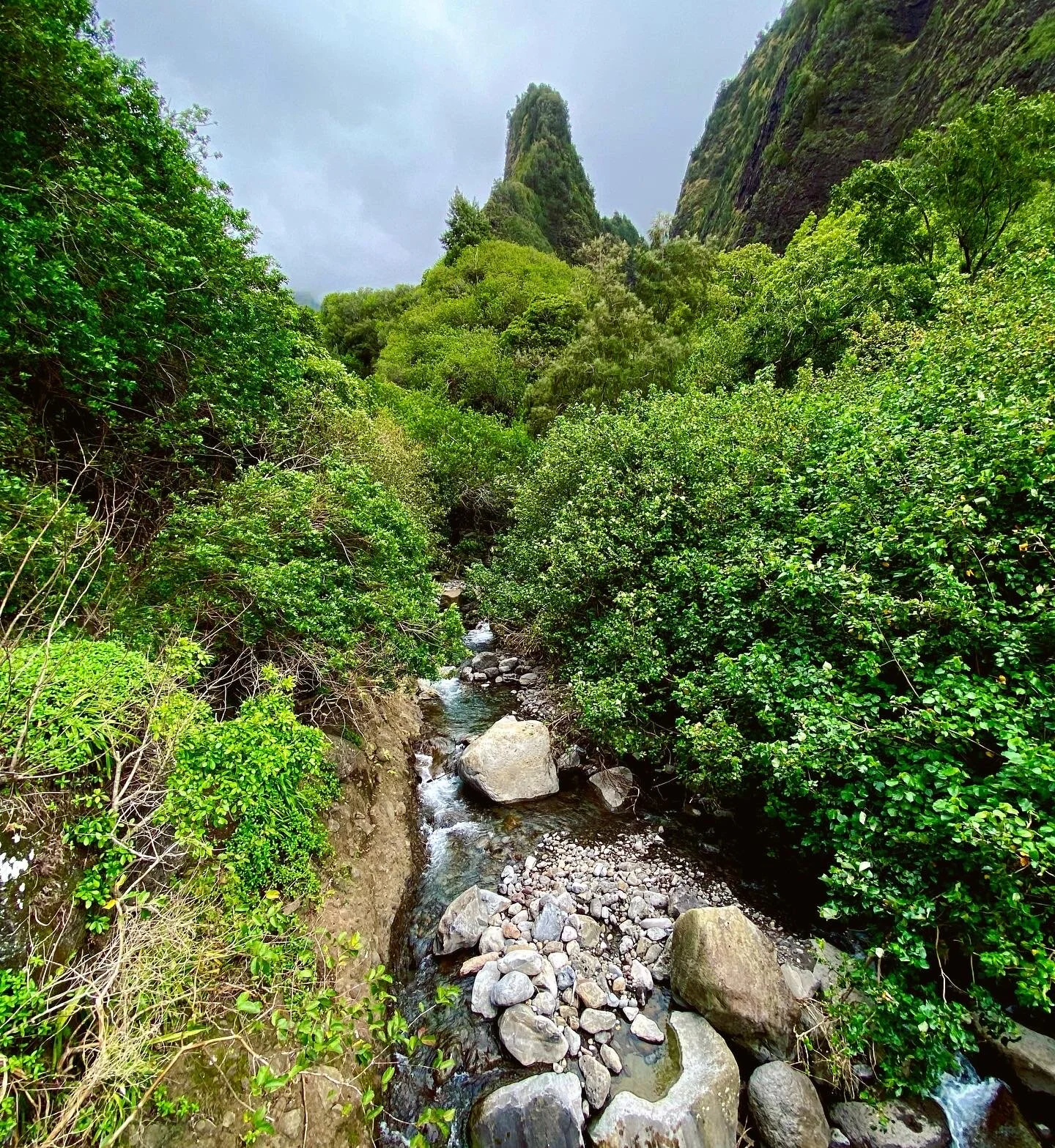
My HIGHEST Recommendation: Mile Marker #41 Haleakala National Park - Kipahulu
Directions: Continuing clockwise past Hana Town, you will find the entrance for Haleakala National park near Mile Marker #41. Parking is $30 per vehicle, $25 per motorcycle, and $15 per pedestrian or bicyclist. Although it is probably the furthest stop on the Road to Hana, there is a lot to do here, so it is best to try and start your day here and work your way back. Pro-tip: For GPS directions, search Kīpahulu Visitor Center.
From this entrance, there are some great hikes in the park, including our favorite trail to Waimoku Falls. You can also follow another trail to take a dip in the Seven Sacred Pools. This is not the same entrance you would use to watch the sunrise at the top of Haleakala, which is located on the other side of the dormant volcano.
The Haleakala National Park site has all info regarding closures as well as hiking trail maps: Click Here
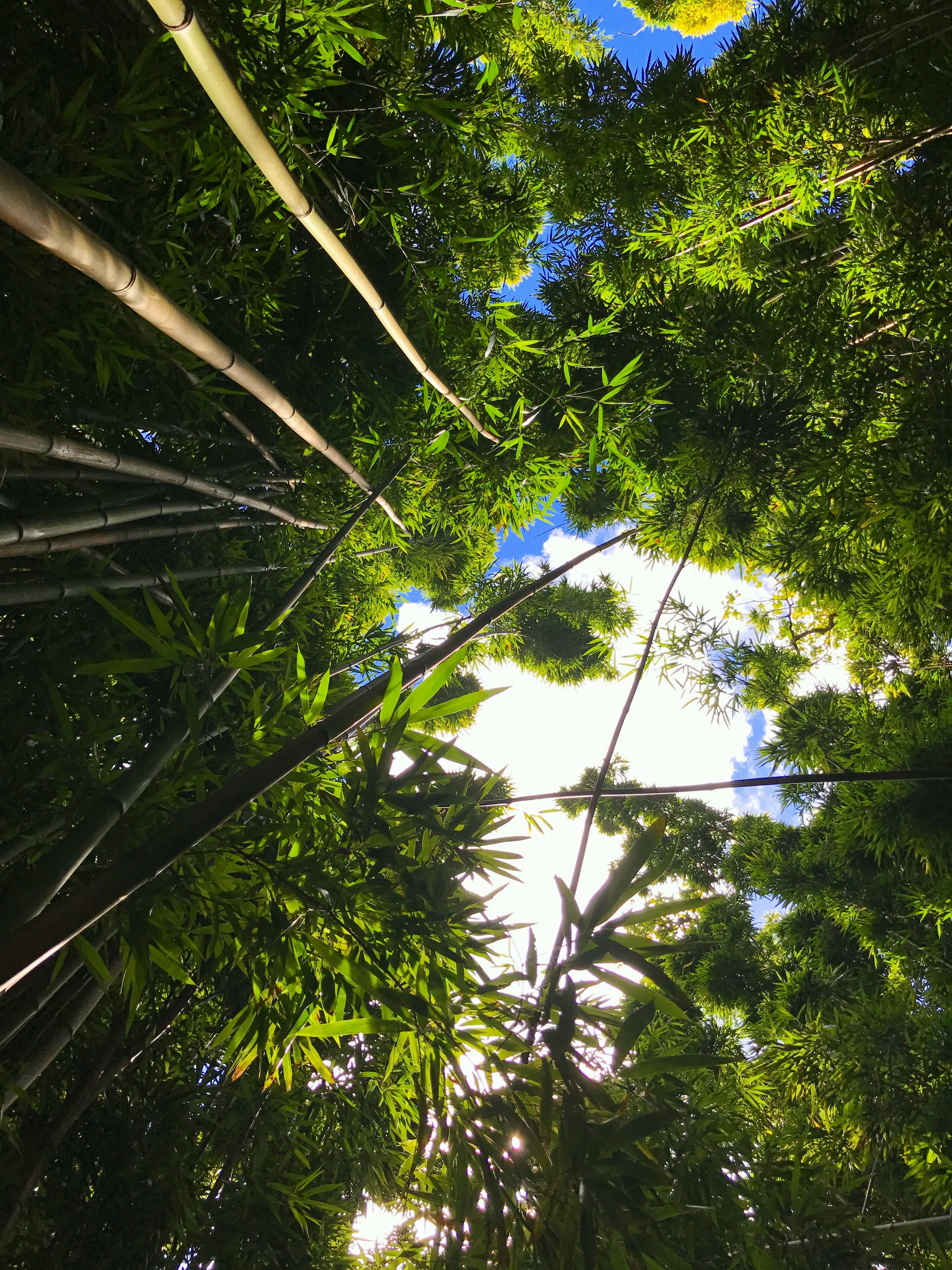
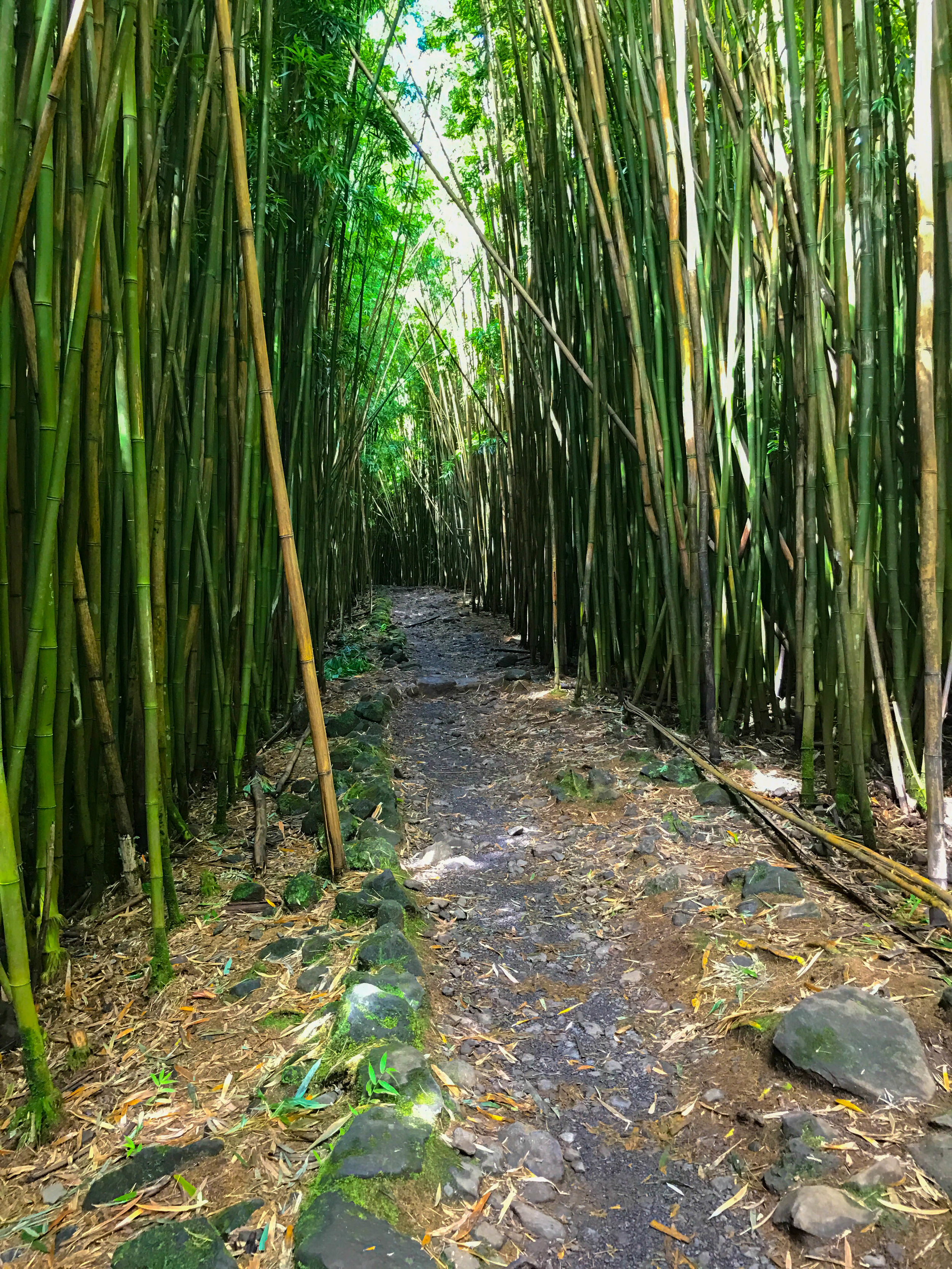
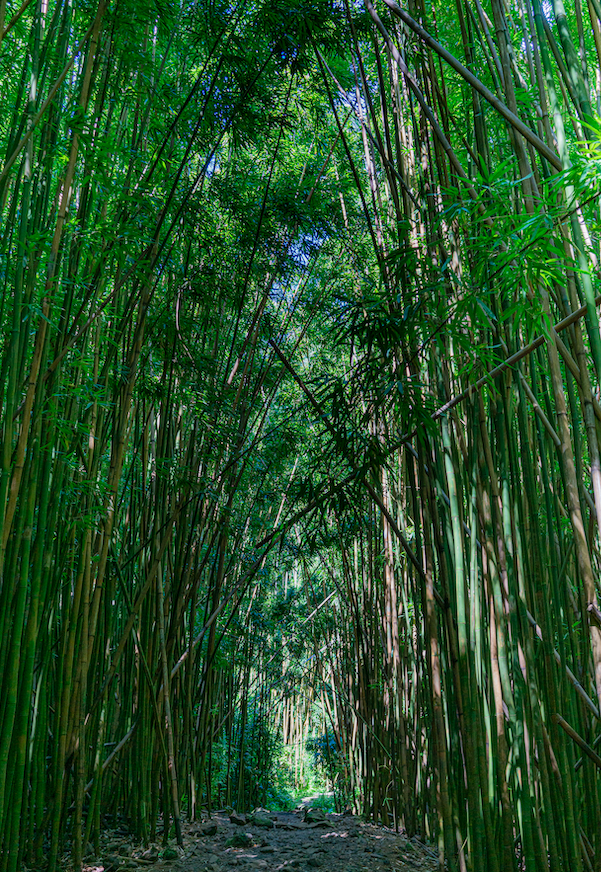
We love hiking with kids on PIPIWAI TRAIL - BAMBOO FOREST
Our favorite hike is to take the Pipiwai Trail, a 4-mile roundtrip hike through the lush bamboo forest, ending at the gorgeous waterfall known as Waimoku Falls.
The hike can be a little steep at times, but not a severe incline, filled with stunning sites and walking through a thick bamboo forest. I loved the sound of the bamboo stems hitting each other in the wind.
WARNING: On one of our trips, there was a "closed" sign due to the fallen trees blocking the trail ahead. Sometimes a ranger patrols the post to prevent people from passing. If violated, you can get a $100 fine, so I'd play by the rules for your safety.

WAIMOKU FALLS - HALEAKALA NATIONAL PARK
After following the Pipiwai Trail, there were signs to follow a trail to get to the waterfall. There were quite a few places where you had to cross streams and jump onto rocks, but that just adds to your "adventurous" life status.
At the end of the trail, you'll be standing and gazing at a huge 400ft waterfall that is known as Waimoku Falls. The more rain, the bigger the stream!
This trail is family friendly! We put our toddler in a hiking carrier and made it all the way to touch their first waterfall! Kids can hike this trail too, there aren’t too many steep parts or cliffs. I like it because it has a lot of shade.
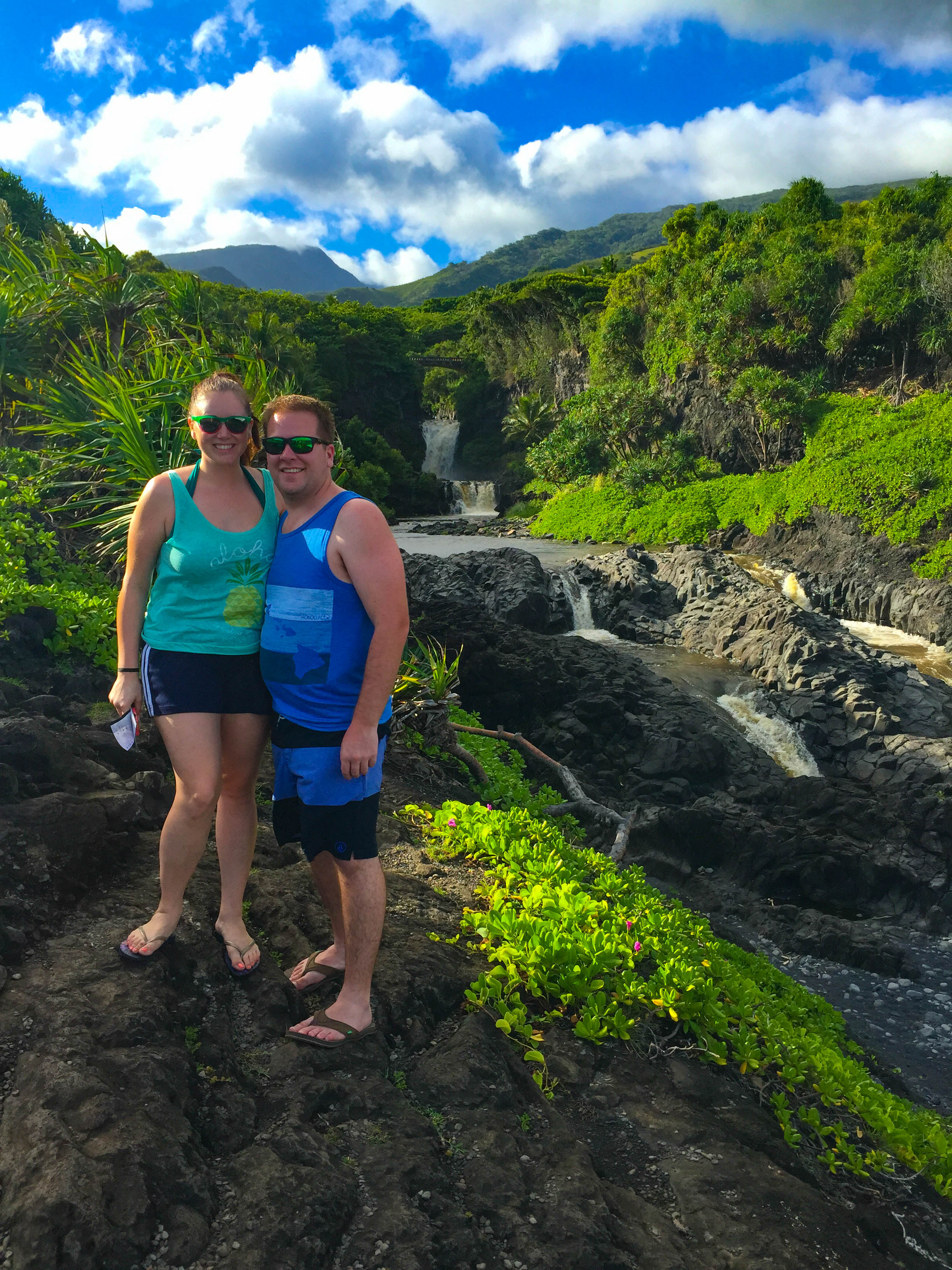
We must stop and swim at Mile Marker #42 'Ohe'o Gulch (Seven Sacred Pools) - in Haleakala National Park
Around mile marker 42, look real quick to catch a glimpse of ‘Ohe‘o Gulch, a cleft in the island that has layered pools and numerous waterfalls on the east end of Haleakala National Park. 'Ohe'o means "Something Special", which definitely suits these special pools. Also known as the Seven Sacred Pools, when water levels are safe, there are actually more than seven pools open to swimming.
Make sure you obey all signs; some areas are known for rock slides and have killed people. Also, be mindful when swimming directly below a fall, as natural debris may flow over.
We finally swam in the pool in October 2019, which was cold but felt refreshing after our long hike. There are tons of slippery rocks that didn’t work out well barefoot or with flip flops. I HIGHLY recommend water shoes with tread.
Haleakala National Park site has all info regarding closures as well as hiking trail maps: Click Here
You can hike here after Pipiwai trail! It’s not far from the parking lot.
🚘 Driving the Road to Hana With Kids
Is the Road to Hana worth it for kids? Yes, but you MUST plan ahead! It is an all day adventure in the car so keep these in mind:
Bathroom stop reality
There are a lot of stops that have restrooms, but not all do
Make sure you know where the closest restrooms are (state parks, general store, restaurant)
Snack strategy - Pack snacks like you are leaving for 5 days
Nap expectations - Hopefully if your toddlers are still napping, they can sleep in the car! If not, maybe a stroller walk around the Black Sand Beach.
When to turn around
Try and make your last stop before lunch your furthest point.
Start making your way back after lunch, you can make more stops along the way as long as your little one(s) can handle it!
Safety near waterfalls
Be Cautious of Freshwater Illness - Avoid swimming if there are posted warnings and don’t let kids swallow waterfall water.
Toddlers and young kids should stay within arm’s reach at all times.
Rocks near waterfalls are often slick with algae so wear water shoes with good grip are safer than flip-flops or bare feet.
Here are the most Toddler Friendly Stops and the order we recommend:
Haleakala National Park for a hike through the Pipiwai Trail (Bamboo Forest) to Waimoku Falls (park near Kīpahulu Visitor Center)
'Ohe'o Gulch (Seven Sacred Pools) for a swim
Lunch in Hana Town - Food trucks will give you the most options
Black Sand Beach (Wainapanapa State Park)
Coconut Glen’s Ice Cream
See more things to do in Maui and full guide for Maui with kids including a 5-day itinerary!
Drive It Yourself vs a Road to Hana Tour
One of the biggest decisions when planning the Road to Hana is whether to drive yourself or book a guided tour. Both options have real pros and cons, and the right choice depends on your travel style.
🚗 Driving the Road to Hana Yourself
Best for: Independent travelers, families with kids, early risers, photographers
Pros:
Go at your own pace
Stop (or skip) whenever you want
Easier with kids who need snack, bathroom, or nap breaks
More flexibility to turn around early if needed
Cons:
The driver can’t fully enjoy the views
Requires navigating narrow, winding roads
Parking at popular stops can be competitive
Good to know:
Starting early (before 7am) makes a huge difference if you’re driving yourself. Roads are quieter, parking is easier, and the experience feels far less rushed.
🚌 Taking a Road to Hana Tour
Best for: First-time visitors, couples, travelers who don’t want to drive
Pros:
No driving stress
Local guides share history and hidden spots
No worrying about directions or parking
Often includes lunch and key stops
Cons:
Fixed schedule and limited stop time
Less flexibility with kids or nap schedules
Can feel rushed at popular spots
Long day sitting on a bus
Good to know:
Tours are a great option if you’re nervous about the drive or want to relax and take in the scenery without navigating tight roads.
⭐ Our Honest Take
If you’re traveling with kids, we strongly recommend driving yourself. The flexibility to stop when you want, adjust the day as needed, and skip crowded spots makes the experience far more enjoyable.
If you’re visiting without kids and prefer a stress-free day where someone else handles the logistics, a guided tour can be a great choice.
There’s no wrong option — the best Road to Hana experience is the one that fits your travel style.
What to Avoid on the Road to Hana
The Road to Hana can be an incredible experience — but a few common mistakes can turn it into a stressful or unsafe day. Here’s what to avoid to make the most of your drive.
🚫 Trying to Do Too Much
It’s tempting to stop at every waterfall and lookout, but that’s the fastest way to feel rushed and exhausted.
Pick a handful of must-see stops
Build in time for bathroom and snack breaks
It’s okay to skip stops and enjoy the drive
🚫 Starting Too Late in the Day
Late starts lead to traffic, full parking areas, and pressure to rush back before dark.
Aim to start before 7am
Morning drives are quieter and more enjoyable
You’ll have better lighting for photos
🚫 Driving Past Your Comfort Level
The road is narrow, winding, and not the place to push through stress.
Turn around if the drive becomes overwhelming
Don’t feel pressured to complete the full loop
There’s no “right” endpoint for everyone
🚫 Parking Illegally or on the Roadside
Illegal parking is one of the biggest safety issues on the Road to Hana.
Never block the road or bridges
Avoid stopping where parking isn’t clearly allowed
Fines are common and roads are too narrow for mistakes
🚫 Ignoring Weather and Water Conditions
Conditions can change quickly, even on sunny days.
Skip waterfall swimming after heavy rain
Avoid muddy, fast-moving water
Respect all posted warnings and closures
🚫 Trespassing or Ignoring Signs
Many roadside areas are private property.
“No Trespassing” signs are there for a reason
Stick to clearly marked public stops
Respect local communities and residents
🚫 Letting Kids Wander Near Water or Roads
This drive requires extra attention with children.
Keep kids within arm’s reach near waterfalls
Watch carefully near roadside pull-offs
Use water shoes and avoid slippery rocks
🚫 Relying on Cell Service
Cell service is unreliable along much of the route.
Download maps ahead of time
Screenshot directions and stop lists
Don’t assume GPS will work everywhere
⭐ Parent Tip
The best Road to Hana days are flexible ones. If kids are tired or conditions don’t feel right, it’s always okay to turn around early — you’ll still see plenty of beauty along the way.
One of our favorite things to do in Maui is to drive the Road to Hana. The road, also known as Hana Highway, stretches around the north to the east coast of Maui, entering through the town of Paia. Stops vary from hiking to waterfalls to gorgeous breathtaking views. You'll even learn some Hawaiian history! Before you head out for your day of fun, this guide will help you map out your stops, provide some Pro Tips, and give you a sense of what to expect for the day. EVERYTHING you’ll need to know is right here!
See our detailed ROAD TO HANA post for more information as to how valuable this guide is!

Click photo for Top 10 Restaurants in Maui
Heading Back Before Dark
After our adventure in Haleakala National Park, we turned around and went back the way we came, stopping for ice cream halfway at Coconut Glen’s (see above - Mile Marker 27.5).
The roads are dangerous as they are narrow and harder to see at night. There aren’t many street lights. It can take up to 3 hours to get from Haleakala National Park back to Kaanapali Beach.
We stopped and had dinner at the infamous Mama's Fish House (make a reservation ahead of time on Opentable).
Pro Tip: You can continue on the Road to Hana from Haleakala National Park, but the roads are very bumpy, narrow (1 lane most of the time), and unkempt. It also breaks your terms with most rental car companies. The safest way is to go back the way you came, especially if it is your first time on the Road to Hana.
TRY OUR FREE ROAD TO HANA GUIDE: CLICK HERE
If you liked this post please share it on your favorite social media site using the Share button below because we’d love to get the word out! Feel free to pin this to your favorite Pinterest board:


🧳 Before you go, check out everything you need to pack for Hawaii here: Packing Checklist for Hawaii 🧳
🗺️ Get your FREE Road to Hana guide by clicking here: FREE ROAD TO HANA GUIDE
See all MAUI POSTS or here are our latest:


6 Great Hiking Trails with Beautiful Views in Maui, Hawaii (Maps included)
Check out our 6 favorite hikes in Maui - Maps and directions included! There are various levels of hikes for families, from easy to experienced hiker status! Try a coastal walk, hike to a waterfall or walk along a volcanic crater! Most of these hikes are free unless you are in a national park.

Haleakala Crater - Halemau’u Trail views
Where to Hike and find Gorgeous Views in Maui, Hawaii
We’ve spent a lot of time on Maui at sea level, deep under the sea (see scuba), and at high elevations! Let’s be clear, I’m not the most outdoorsy experienced hiker, but I do love a nice hike and killer views! Try a coastal walk, hike to a waterfall or walk along a volcanic crater! Most of these hikes are free unless you are in a national park. Here are some hike suggestions for novice, intermediate, and experienced hikers!
See our shopping list (with some great budget-friendly dresses and tons of Hawaiian outfit ideas) straight from Amazon: Hawaii Packing Essentials
This guide is part of our Ultimate Maui Travel Guide, which covers everything from family travel to honeymoons and first-time visits.

Haleakala Crater - Halemau’u Trail
1. Haleakala Crater - Halemau’u Trail
Address: Halemau'u Trailhead, Halemauu Trail, Kula, HI 96790
Follow Haleakala Highway east for 7.8 miles and turn left on 377 to continue on Haleakala Highway, which will travel south another 6 miles to a junction with Crater Road (378). Turn right and follow Crater Road 20.7 miles to the Haleakala Visitor Center.
The Hike: Haleakala offers a few hikes at various elevations. We opted for the Halemau’u Trail.
Haleakala National Park charges a fee to enter. Fees are $30 per vehicle or $25 per motorcycle. If you are entering on foot or bike the fee is $15 per person. You can also purchase a park-specific annual pass for $55. You need a reservation if you want to start before 7am because of the sunrise crowd.
Duration: The Halemau’u Trail is a 7+ mile hike at 3000 ft along the rim overlooking the summit basin. From the rim you can extend your hike taking the trail switchbacks down a thousand feet to wilderness grassland, then crosses a volcanic landscape of cinder cones and lava fields. I was 6 weeks pregnant and we did a shorter 2 mile hike along the rim that took us almost 2 hours.
What to pack: water, sunscreen, hat, sunglasses, rain gear (the weather can change very fast)
Pro tip: Plan the hike about 2 hours before sunset, so you can hike and then head up to the top of the summit to watch the sunset. Pack some sandwiches for dinner and then stargaze! You can see the Milky Way most nights!

Haleakala Crater - Halemau’u Trail Hike map

Waimoku Falls at the end of Pipiwai Trail
2. Road to Hana - Pipiwai Trail (Bamboo Forest)
Address: Kīpahulu Visitor Center, Hana, HI 96713 (Parking lot)
Haleakala National Park charges a fee to enter. Fees are $30 per vehicle or $25 per motorcycle. If you are entering on foot or bike the fee is $15 per person. You can also purchase a park-specific annual pass for $55.
The Hike: We’ve done this hike quite a few times and it never disappoints! You’ll find this near the end of the Road to Hana in Haleakala park. First you’ll hike on a trail through the trees (around the big banyan tree), then through a bamboo forest, and you’ll end up at Waimouku Falls!
Difficulty: Fairly easy - Pipiwai Trail is great for families and kids. It can get muddy in spots so wear proper shoes and watch where you step!
Duration: It’s about 4 miles round trip and takes at least 2 hours. The elevation is about 650 ft and the trail is moderately easy.
What to pack: water, sunscreen, hat, sunglasses, snacks, towel and swimsuit if you want to dip in the waterfall or ‘Ohe’o Gulch
Check out what else you can do on the Road to Hana
Pipiwai Trail - Bamboo Forest - Road to Hana - Maui
3. Wailea Trail - Hoapili Trail
Address: 8650 Must Hold Block Boundary, Kihei, HI 96753
The Hike: After you pass the fancy resorts in Wailea, if you continue down Makena road, it dead ends with a nice hiking trail along the water. Sometimes you can see dolphins early in the morning - look at the wakes of the boats! We were lucky enough to find a Hawaiian Monk Seal that had just given birth days prior and was on the shore with her pup. This hike begins at La Pérouse Bay. We took the Hoapili Trail to the Hanomanioa Light House where at the end of the trail is one of those natural pools that you often see influencers float in on Instagram. If you’re lucky, you’ll come across some black mountain goats along the way! There are also great little spots along the beach to stop and have a small private beach area all to yourself!
Difficulty: Moderate - the first mile is easy and shaded along the beach. The lava field can be a little slippery with loose lava gravel and is in full sun. Hoapili Trail is good for families, I wouldn’t take toddlers on the lava field unless you are carrying them in a carrier. It gets hot - bring WATER!
Duration: To get to the lighthouse and natural pool it’s about 3 miles.
What to Pack: water, sunscreen, hat, sunglasses (the trail is shaded at first, but the lava fields are in full sun), towel and swimsuit
See our shopping list (with some great budget-friendly dresses and tons of Hawaiian outfit ideas) straight from Amazon: Hawaii Packing Essentials

Wailea Natural Pool - Hoapili Trail

Kapalua Coastal Trail
4. Kapalua Coastal Walking Trail
Address: 99 Coconut Grove Ln, Lahaina, HI 96761
The Hike: Looking for an easy stroll along the beach with fantastic views? This is your trail! This path is pretty much paved the entire way and a great coastal walk if you’re not in the mood to walk in the sand. We parked near Merriman’s in the public parking lot. Get there early for a spot or park along the street.
Difficulty: Easy! Great for families, a lot of it is paved. Kids and toddlers can walk themselves!
Duration: Per my Apple Watch, we walked 37 mins for 1.57 miles from the parking lot to Oneloa Bay and back.
What to Pack: Flips flops or tennis shoes (shoes are better for your feet), water, sunscreen, hat, sunglasses
See our shopping list (with some great budget-friendly dresses and tons of Hawaiian outfit ideas) straight from Amazon: Hawaii Packing Essentials

Kapalua Coastal Trail Map

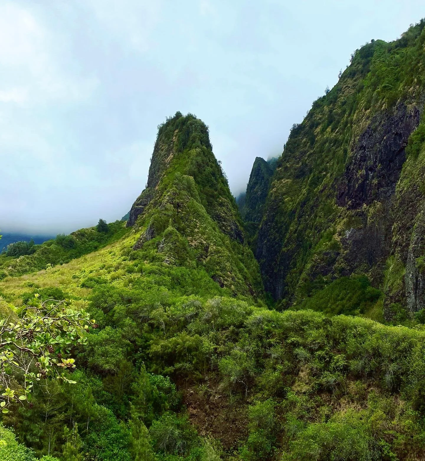
Iao Needle in Iao Valley
5. Iao Valley Hidden Trail
Address: 54 S High St, Wailuku, HI 96793
Hours: Daily, 7:00 AM - 6:00 PM
Parking Prices: Non-Commercial Vehicles
Residents = No Charge w/ID or DL
Non-Residents = $10
Entrance fee - $5 for non-residents
The Hike: This hike is fun through the jungle and shaded almost the entire way.
If you’re looking for a very short hike, there is a paved trail to the Iao Needle viewpoint. There is a lookout with a gazebo to hike to that has some benches with views of the needle. It was an easy hike, only .6 miles, 200 ft in elevation, and a quick 10-minute walk from the parking lot.
There is a trail behind the gazebo, but there are signs to not pass the barriers. This trail is dangerous and should be avoided. However, if you head down to the stream and hike up the mountains you’ll end up on the same trail just past the steep dangerous part. See the screenshot map below.
Difficulty: Fairly easy - it was nice and cool under the trees! There is a steep incline the last quarter mile but otherwise it was pretty smooth. There was some mud because there is often rain on this part of the island.
Duration: I did this hike at 6 weeks pregnant! We took it a little slower so it took us an hour and 45 mins to get to the top of the lookout which was about 2 miles and an elevation gain of 1061 feet. It was a little muddy at times so be careful! The trail doesn’t have any markers, but the path is pretty well-traveled so just stay on that which will take you to the top.
What to pack: Water, snacks, and a towel/swimsuit if you want to jump in the stream
See more in our post: Exploring Iao Valley
Iao Valley Secret Trail Map

Views from Waihee Ridge Hiking Trail
6. Waihee Ridge Hiking Trail
Address: Kahekili Hwy, Wailuku, HI 96793
Directions: Drive along the north shore to the trailhead. Parking is free but get there early for a good spot. There are Porta potties in the parking lot.
The Hike: The hike is in mainly in the sun along a mountain ridge. The view stays pretty much the same as you hike up, you are just higher in elevation.
Difficulty: Moderate - there is a pretty steep incline in some spots. We took a few breaks on our way up.
Duration: It was a nice sunny hike that took us about 2 hours round trip, over 2 miles, and almost 1500 ft in elevation per my Apple Watch.
What to pack: water, sunscreen, hat, sunglasses, snacks, towel
If you liked this post please share it on your favorite social media site using the Share button below because we’d love to get the word out! Feel free to pin this to your favorite Pinterest board:

Check out more Maui posts:

Exploring Iao Valley and seeing the Iao Needle - Maui, Hawaii
Check out our Iao Valley State Park Guide and map for the hidden hiking trail around the Iao Needle! As one of the iconic sites in Maui, Hawaii, you can’t miss this day trip! Things to do in Maui
Iao Valley State Monument - Iao Needle
Iao Valley State Park Guide and hiking around the Iao Needle
Iao Valley is a fun place to spend the day exploring! There are walking and hiking trails, streams to swim in, plenty of wildlife to check out, and the iconic Iao Needle. I went to Iao Valley with my family when I was a kid so I was excited when we were able to go back this past trip! We tried to go in October 2020 but the park was still closed.
Note: The mountains tend to keep in moisture and Iao Valley is known as the second wettest spot in Hawaii. It’s not always sunny, which is nice when it keeps it cool. Be prepared for a little mud if you’re hiking.
This guide is part of our Ultimate Maui Travel Guide, which covers everything from family travel to honeymoons and first-time visits.
How to Get to Iao Valley and Where to Park
Address: 54 S High St, Wailuku, HI 96793
Hours: Daily, 7:00 AM - 6:00 PM
Parking Prices:
Non-Commercial Vehicles
Residents = No Charge w/ID or DL
Non-Residents = $10
Commercial PUC vehicles:
1-7 passenger vehicles: $25
8-25 passenger vehicles: $50
26 + passenger vehicles: $90
Entrance Fee:
As of April 19th, 2021, all non-Hawaii resident visitors to ʻĪao Valley State Monument will be required to purchase an entrance pass as well.
Individuals – Walk-In
Residents = Free w/Hawaii DL or ID
Non-Residents = $5
Children 3 and Under = Free
Iao Valley State Park is located in Wailuku which is on the north side of Maui. Coming from Kaanapali, you can drive around to the valley from the North or South. The drive coming North is scenic but comes down to one lane in certain spots, let’s face it, the south drive is pretty too and a bit faster taking the highways. If you’re heading there from Wailea, just head towards the airport and keep going a bit!
There’s a parking lot that tends to fill up around 10/11am. There is a fee to park on the lot, but if you can find a free spot on the street just before you enter the parking lot. The best time to go is around 8am to get a clear view of the Needle, clouds can form around it in the afternoon obstructing the monument.
There are public restrooms just off the parking lot, although when we went in February they were closed and port-a-potties were set up in the parking lot.
Kahalawai is an old extinct volcano, eroded over the last million years into the West Maui Mountains. Its highest remaining point is Mount Kukui at 5,788 feet above sea level. The head of ‘Iao Valley stands at what remains of the summit crater of Kahalawai in the West Maui Mountains. Over time, wind and water worked at Kahalawai, digging deep into areas of softer rock, eventually collecting into streams and forming deep valleys. Today four major streams, the Nakalaloa, the Poohoahoa, the Kinihipai, and the Ae, make their way down the West Maui Mountains to converge into Iao stream. The ‘Iao stream then travels to the ocean through the valley we see today. The 1200 foot tall Iao Needle, known to Hawaiians as Kuka’emoku, is what remains of a ridge that used to run down the length of Kahalawei.
What to Bring:
Bring some water if you’re hiking and make sure you wear sneakers. If you’re planning on going for a swim bring your suit and towel! There isn’t a place to get food on premises unless you eat the fallen fruit from the trees, so you might want to pack snacks.
Exploring Iao Valley
There are a few things to do in the park:
Go for a hike! Hike along stream or up in the mountains, there’s a trail for everyone!
Take in the Iao Needle! There is a short paved trail with a small incline with a few steps to see the famous 2250-foot-tall Needle.
Catch up on some Hawaiian History. Did you know one of the biggest battles in Hawaiian History was fought in this valley?
Explore the Botanical Garden.
Go for a swim! After our hike, we were a bit muddy and warm. The stream water is cool and soothing!
Warning: Maui is known to have flash floods, especially in the West Maui Mountains. Just beware of the weather, sometimes it’s raining high in the mountains but not in the valley. Be cautious when swimming, and if you notice any change at all in the color or level of the water, seek higher ground immediately.
Should we bring kids? Sure! Kids would enjoy the stream and climbing on rocks!

Iao Valley Stream

Hiking obstacles along the hiking trail!
Hiking Iao Valley
Whether you are an advanced hiker or just looking for a leisurely stroll, there’s a trail for you!
Off the parking lot, there is a paved trail to the Iao Needle viewpoint. As a kid, I thought we did a long hike up to see the needle but now there seems to be a lookout with a gazebo to hike to that has some benches with views of the needle. It was an easy hike, only .6 miles, 200 ft in elevation, and a quick 10-minute walk from the parking lot. What’s so special about the Needle? It’s an interesting rock formation that is really the vertical edge of an eroded ridge.
There is a trail behind the gazebo, but there are signs to not pass the barriers. This trail is dangerous and should be avoided. However, if you head down to the stream and hike up the mountains you’ll end up on the same trail just past the steep dangerous part.
I did this hike at 6 weeks pregnant! We took it a little slower so it took us an hour and 45 mins to get to the top of the lookout which was about 2 miles and an elevation gain of 1061 feet. It was a little muddy at times so be careful! The trail doesn’t have any markers, but the path is pretty well-traveled so just stay on that which will take you to the top. Here is the trail we took starting along the stream:

Hiking Stats for Iao Valley

2 mile hike path to lookout - Iao Valley

Iao Valley Fern - Vegetation and Plant life
A Landmark of Hawaiian History
Iao Valley was the location of one of the bloodiest battles in Hawaiian history! Per our friends at MauiGuide.com:
In 1790, King Kamehameha I of the island of Hawai’i (the Big Island) battled army leader Kalanikupule of Maui. The armies were evenly matched, and the battle raged for days. Kamehameha was only able to overcome Kalanikupule when he obtained access to a cannon. Many people from both sides died in the battle, their bodies clogging the waters of ‘Iao stream, and giving the battle the name Kepaniwai, “Battle of the Damned Waters of ‘Iao.”
People of Maui considered ‘Iao stream to be of great importance. They built homes along its edges and used the water for drinking and agriculture, particularly growing taro. Certain areas in the valley were revered as sacred burial sites for chiefs of Maui.
Visiting the Iao Needle is a fun place to explore and great way to spend the day! Hope this guide helps you enjoy the park!
Please note this is not a sponsored post and based on my own personal experience, all thoughts are my own.
If you liked this post please share it on your favorite social media site using the Share button below because we’d love to get the word out! Feel free to pin this to your favorite Pinterest board:

Exploring Iao Valley and seeing the Iao Needle
More Maui Posts:

Malibu Wine Hikes - Best Hike in Los Angeles, California
Malibu Wines is a wonderful place to go for an outing with friends in LA. We hiked, saw some animals, savored rosé pops, got some wine to go, had some laughs - it was a perfect way to spend the day outside and socially distant. You may remember my Malibu Wines Safari post or the Malibu Wines Tasting Room in West Hills, but this time we tried a new experience, Malibu Wine Hikes!
Malibu Wine Hikes Trail and Saddle Rock Wine!
Malibu Wine Hikes - The best thing to do outside in LA!
Address: 32111 MULHOLLAND HWY. MALIBU, CA 90265
Malibu Wines is a wonderful place to go for an outing with friends in LA. We hiked, saw some animals, savored rosé pops, got some wine to go, had some laughs - it was a perfect way to spend the day outside and socially distant. You may remember my Malibu Wines Safari post or the Malibu Wines Tasting Room in West Hills, but this time we tried a new experience, Malibu Wine Hikes!

Malibu Wine Hikes Trail
Our Wine Hike Experience
I went with 7 of my girlfriends, who I hadn’t seen since the beginning of the year! We wore masks (took them off for pictures) and kept our distance, it was so nice to see them in person and not on a screen!
We checked in and waited in the shade for our guide, Joe! He was nice, entertaining, and knew so much about the vineyard and grounds. Since we’re all concerned about the spread he took photos of us throughout the hike and sent them to us in a dropbox at the end of the day. This was above and beyond our expectations.

Strike a pose in the Santa Monica Mountains
Typically the hike starts with Rosé pops, but ours weren’t frozen enough, so they gave them to us at the end.
We toured around the grounds on a 2-mile loop, the trail wasn’t too steep. It took us about 3 hours, but we weren’t in any rush, just enjoying the sunshine and company. There were water stations at the beginning of the hike and about halfway through. You can bring your own reusable bottle or purchase one of theirs.
Joe would point out the crops that were growing in the gardens, and said we could try the berries (SNACKKKS).

Berries on the hike!

White Sage growing
There are even Chumash Native Cave paintings on the property and if you’re lucky, you might even find one of their spearheads!
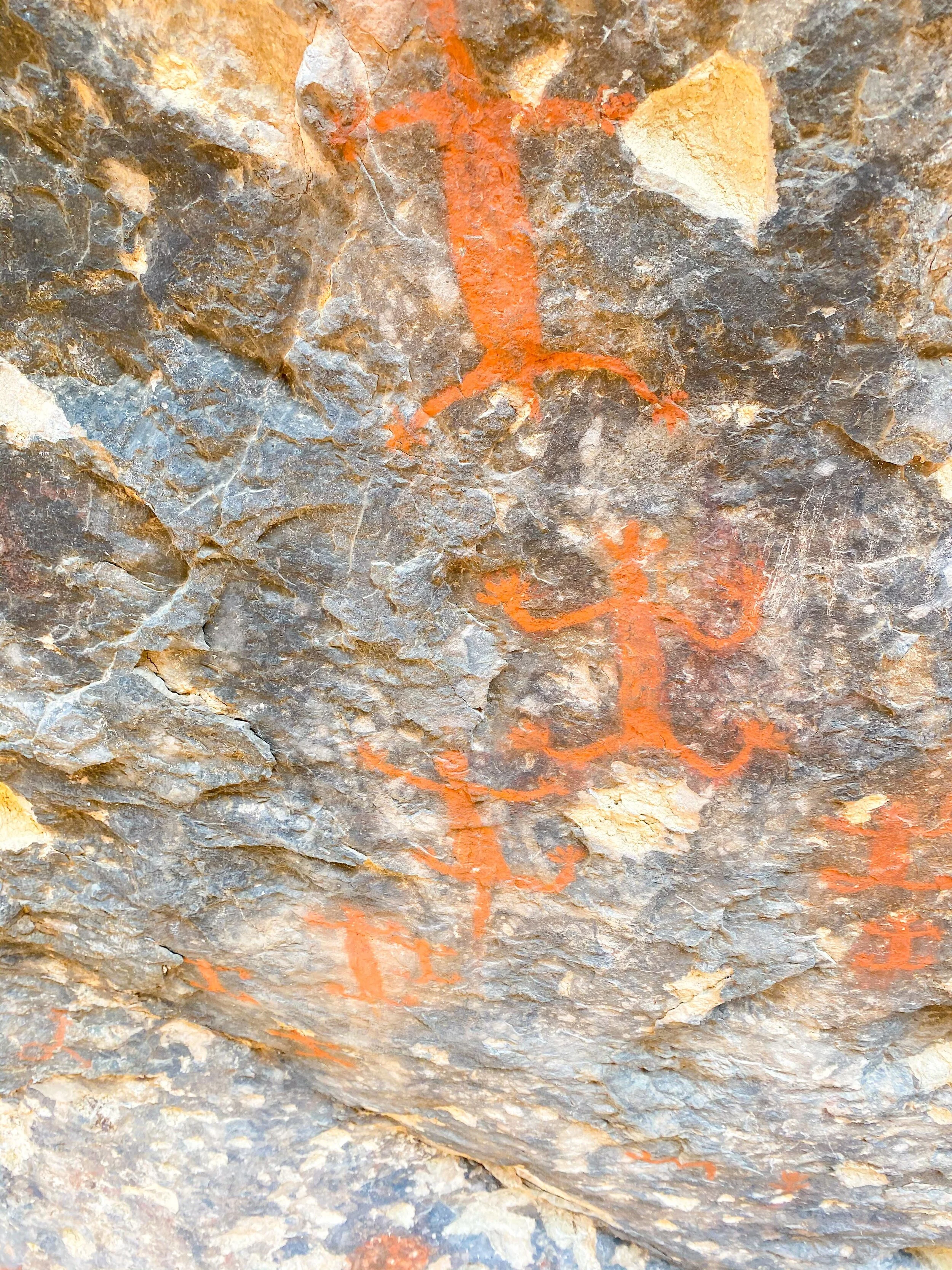
Chumash Native Cave Paintings
The Woolsey fire in November 2018 took out the tasting room and a lot of the vegetation on the grounds. Luckily the animals were ok and from our hike, many of the crops came back and a lot of the vineyard survived! 2020 hasn’t been easy for anyone, but their safety protocols and open-air tours make it easier for people to be together and still do fun things! We saw zebras, water buffalo, and other animals!

Malibu Wines Zebras
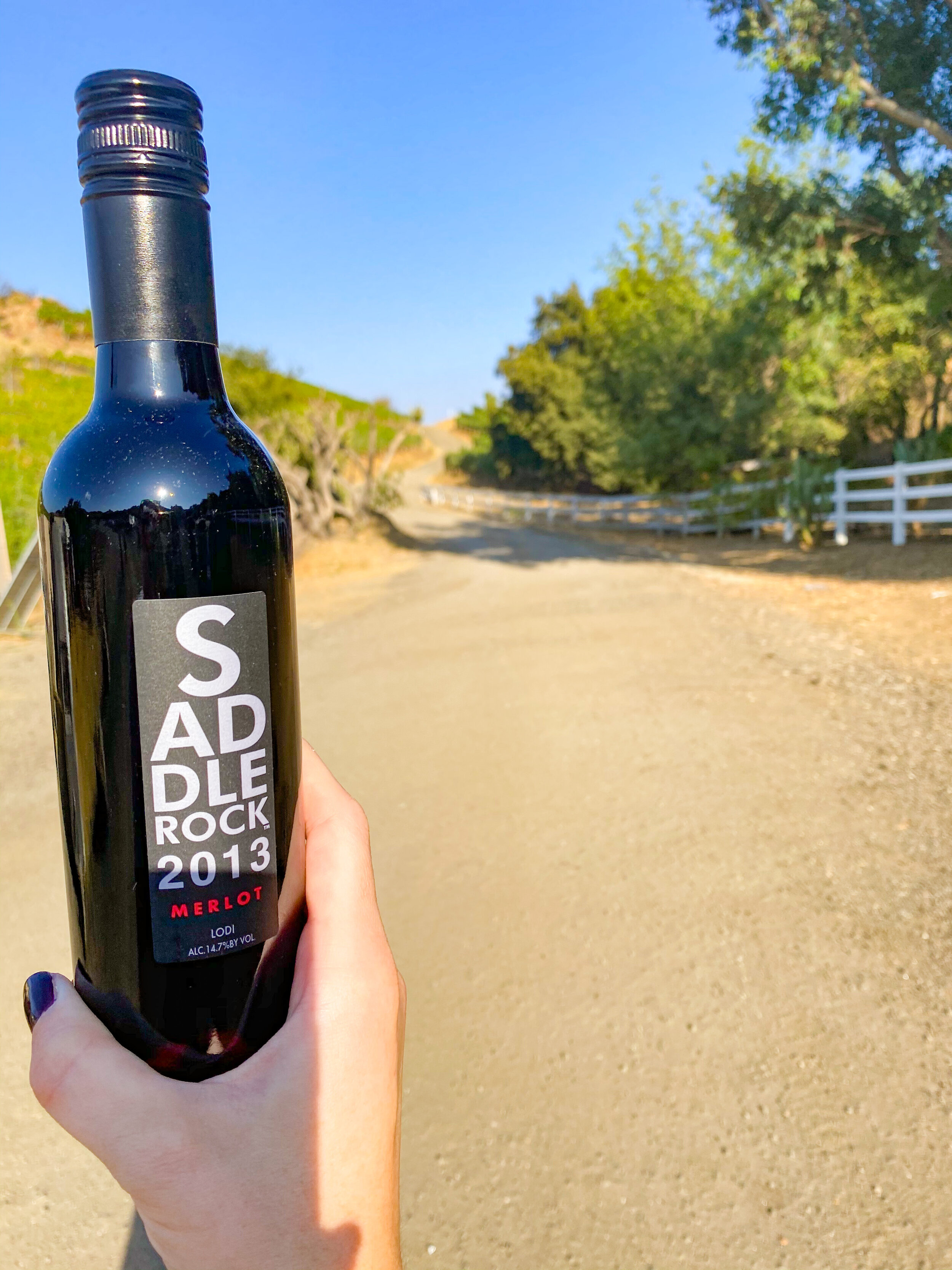
After we were done touring around, we returned back to the entrance where we had our rosé pops and chose our bottle of wine to take to go. I like their rosé but went with the Merlot, which is a nice red with notes of spice and pepper. These weren’t full bottles but enough for 2 large glasses of wine!
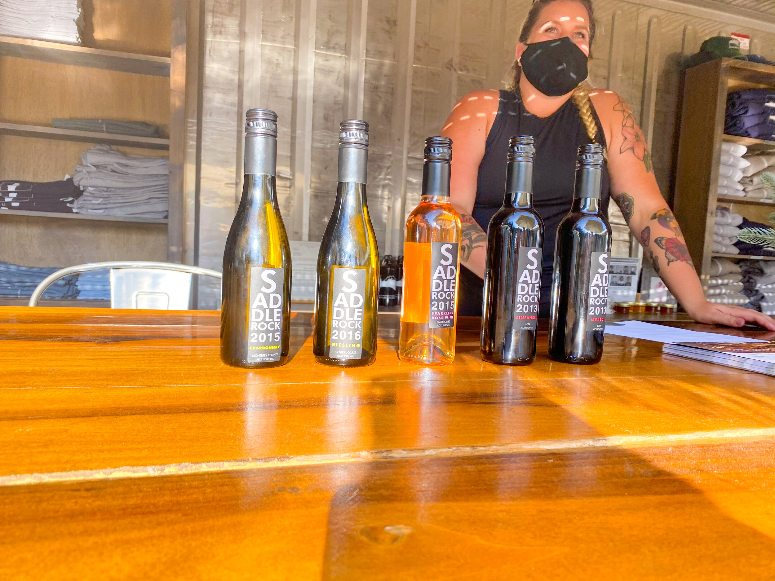
Saddlerock wines
Booking Your Hike Reservation
The grounds are not open to any to walk around, you must be on a tour or attend an event. Book your ticket and reserve your spot on malibuwinehikes.com. We booked 3 weeks in advance to get our desired date and time.
WINE HIKE - The open hike is a 2 mile loop hike where you get to explore the vineyards of Saddlerock Ranch, organic gardens, Chumash Native American cave paintings, and more! Guests will receive wine to-go when the hike concludes. $49/person
4x4 VINEYARD TOUR - There is also a vineyard tour that you ride in a 4x4 for an adventure tour around the Saddlerock Ranch Vineyards. Guests will explore the vineyards and natural areas on the property. Includes snacks, beverages and wine to-go! $375/Vehicle (each vehicle holds 1-5 people).

Saddle Rock Ranch Sign
Arrival and Parking
There is a huge dirt and gravel parking lot with plenty of parking spots. There are also nice trailer bathrooms in the parking lot too, better than a port-a-potty, but it’s not the Four Seasons or anything.
Don’t drink and drive!
If you liked this post please share it on your favorite social media site using the Share button below because we’d love to get the word out! Feel free to pin this to your favorite Pinterest board:

Other great LA posts:


10 FUN things you must do in Wailea - Maui, Hawaii
Wailea is a great place for pretty much anything! See our top ten things to do and see in Wailea, Hawaii, including hiking, finding secret beaches, snorkel around turtle town, golf, shop, and more! Free things to do and things to do with kids in Wailea.
Top Ten Things to do and See in Wailea, Hawaii
First or sixth trip to Hawaii? Doesn’t matter, check out these fun things to do in Wailea! It’s a pretty coastal drive if you’re staying in Lahaina or a great place to stay for a few nights! We stayed at the Grand Wailea and fell in love with Wailea!
Not sure which area is right for you? Our Ultimate Maui Travel Guide compares Kaanapali, Wailea, and other regions.
Here’s a list of what to do in Wailea, Maui:
Go for a Hike in Wailea
Wailea hikes are the best way to start the day! At the end of Makena Road just past Wailea, there is a trail to hike around old lava fields. We were lucky enough to find a Hawaiian Monk Seal that had just given birth days prior and was on the shore with her pup. We took the Haopili Trail to Hanomanioa Light where at the end of the trail is one of those natural pools that you often see influencers float in on Instagram. If you’re lucky, you’ll come across some black mountain goats along the way!

Hike to the natural pools in Wailea
2. Find a Secret Beach in Wailea
Maybe it’s not such a secret if I’m telling you. Again, At the end of Makena Road just past Wailea, if you’re not in the mood to hike (see #1), there are little beach coves that only fit a few people so you can jump in the water, do yoga, read a book, have a picnic lunch, or take a nap! It’s a private beach all to yourself! Pro Tip: Claim your spot early.

Secret Beaches in Wailea
3. Enjoy a day by the beach!
Beach chairs are provided by most hotels, you just have to get there early to nab one. We stayed at the Grand Wailea and would grab a few chairs around 8am to be in the front row.
4. Snorkel around Turtle Town
Wailea has some great spots for snorkeling, but you have to check out Turtle Town. Turtle Town is where the turtles come to have the cleaner fish pick off the algae and other parasites living on their backs! We also saw quite a few turtles right near our hotel (Grand Wailea).
Related posts: Best Snorkel Spots in Maui and Best Scuba Spots in Maui

Snorkel around Turtle Town in Wailea
5. Visit the Turtles in Wailea
Right off the back of a Makena Landing parking lot (5083 Makena Alanui, Kihei, HI 96753), you’ll often find turtles resting in the sand/rocks. Don’t disturb them, but admire them from the trees! Also, there were tons of chickens chasing each other in the parking lot.

Resting Turtles in Wailea
6. Go Shopping in Wailea!
I always love shopping! The Shops at Wailea have everything you need from high-end stores like Louis Vuitton to the ABC Store! Lappert’s ice cream can be found here and you’ll smell the fresh waffle cones wafting in the air when you get close! Soha Living has the cutest coastal decor, which makes great souvenirs! The Island Gourmet Markets is the best Wailea grocery store and their coffee shop brews a delicious coconut macadamia nut latte!
7. Pineapple Wine Tasting
There is a vineyard on Maui and it’s not far from Wailea! Have a taste of Maui Wine’s famous pineapple wines, exclusive small production estate wines, and sparkling wines.
FUN FACT: The King’s Cottage was originally built in the 1870s to welcome King Kalākaua himself, the last reigning king of Hawai’i. He would come to ‘Ulupalakua to enjoy a little royal vacation time with lavish dinners, dancing, champagne, and celebration. Maui wine continues that celebration today, this time inviting all of you! Complimentary guided tours of the historic estate, production area, and wine cellar.
8. Golf in Wailea
Josh loves to golf and there is a fantastic course (Wailea Golf Club) with gorgeous views in Wailea. The Wailea Gold Course is not only gorgeous but one of the top 100 courses in America!

Wailea Golf Club
9. Restaurants in Wailea
Do some fine dining - you’re on vacation! Monkeypod Kitchen is a MUST, their mai tais are my favorite on the island (food is fantastic too)! We also really liked Lineage (Top Chef, Sheldon Simeon’s restaurant), conveniently located in The Shops at Wailea shopping center.
10. Spa Day in Wailea
You’re at the beach in Hawaii, RELAX! Go for a nice massage and then grab a drink by the pool. Many of the resorts have spas, don’t be afraid to try them. This is the ultimate vacation life!

Grand Wailea Luau - Best in Wailea
BONUS TIP: Don’t miss the Grand Wailea Luau!
If you walk along the pathway at night, you’ll hear the drums and luau music play. You can kinda see what’s happening on the luau stage as you stroll by, but you should experience the show along with a traditional Hawaiian dinner! The Marriott Wailea luau puts on a good show too. Get a great price on luau tickets with Activity Authority!
Maui is part of ListForAll.com’s TOP 25 TROPICAL VACATIONS and I think these are some good reasons for Maui to make that list!
If you liked this post please share it on your favorite social media site using the Share button below because we’d love to get the word out! Feel free to pin this to your favorite Pinterest board:

Things to do in Wailea - Maui, Hawaii
All MAUI POSTS HERE or the latest and greatest:

Best Lake Tahoe Hiking Trails for the Casual Hiker
Lake Tahoe is a great place for hiking, even for those who casually hike! Here are 2 hiking trails for the whole family to enjoy (dogs too)! Check out the Cascade Falls Trail and the Eagle Lake Trails near Emerald Bay in Lake Tahoe, California. Things to do in Lake Tahoe #Hike #California #LakeTahoe

Best Emerald Bay Lake Tahoe Trails
Updated April 10, 2026
There are endless options of hiking trails and waterfalls in Lake Tahoe. The best Lake Tahoe Hiking Trails are Eagle Lake and Cascade Falls for the occasional hiker.
I love to go hiking but I would not categorize myself as a “hiker.” I like trails with a mild incline, shade, pretty views, and something more strenuous than just a walk outside. Doesn’t everyone? We spent a weekend in Lake Tahoe and tried a different hike each morning. These trails, Eagle Lake & Cascade Falls, came pretty close to my description. Along the trails, we saw many families with small children and lots of people with dogs ranging from all sizes. Almost anyone can enjoy these moderate hikes!
Related Post: Guide to Lake Tahoe Summer Weekend Getaway - Everything you need to know about Tahoe!
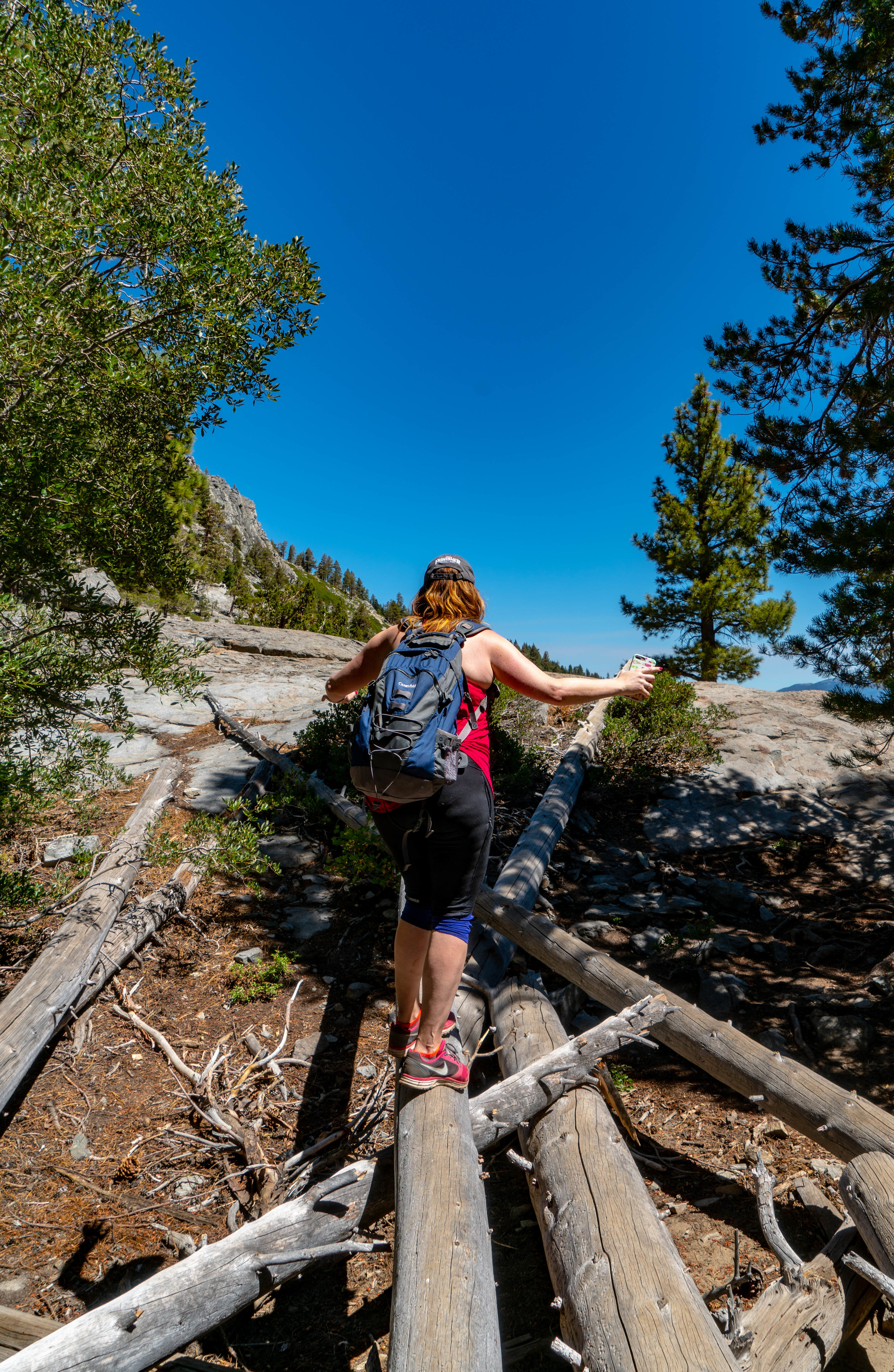
EAGLE LAKE TRAILS
Distance: 1.8 miles (round trip)
Elevation Gain: 433 feet
Time: 2 hours if you want some time to explore around the lake or even jump in for a swim!
Parking: There is a very small parking lot off the trailhead but it fills up quickly! You’re better off parking along the road as soon as you see the sign. Try to get there before 10a for a good spot!

This moderate hike trails from the top road along Emerald Bay through the wilderness to a small lake nestled in the trees. Start at the trailhead and fill out a permit which is just filling out some contact info and holding onto a piece of paper.
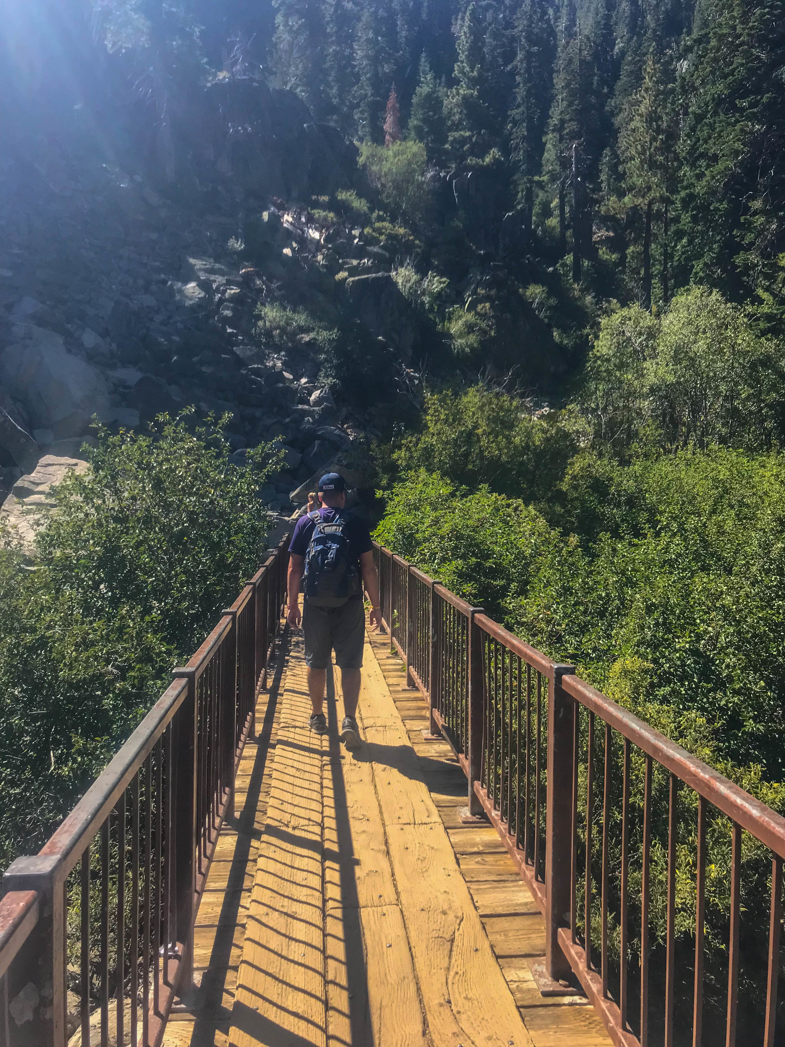
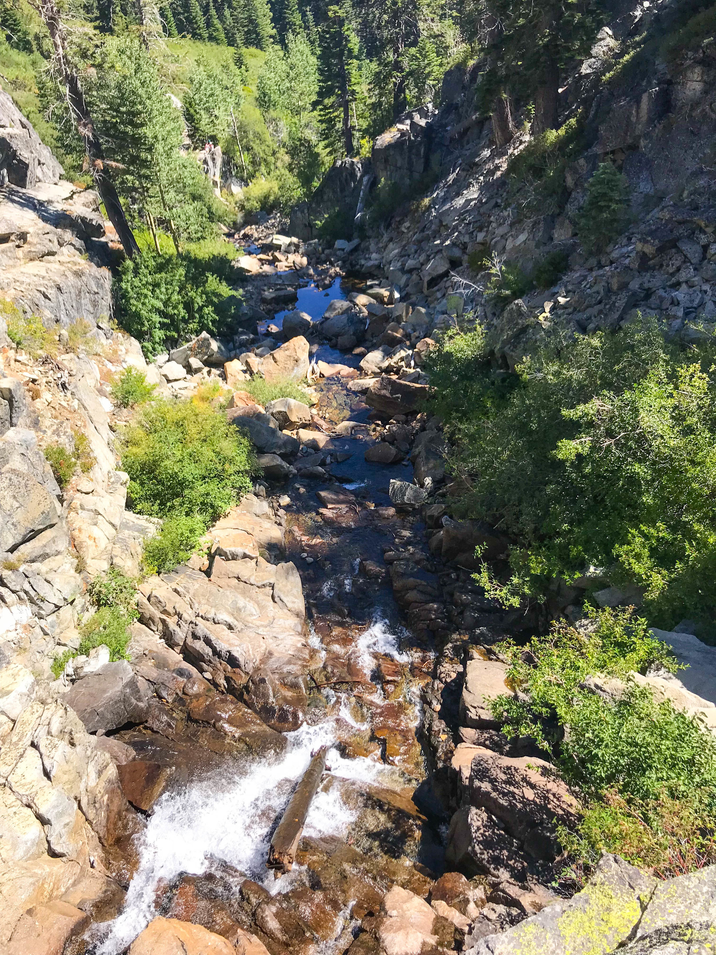
Start heading Southwest up the stairs to the bridge and enjoy the waterfall.
We hiked up to a ridge, hugged some trees, had some fun, and took a few pictures!

Emerald Bay view along Eagle Lake Trails


SISTER, STAND RIGHT HERE. JK, I LOVE MY SISTER!
From the ridge, we continued down the trail until we hit a fork in the road and the sign had fallen down. Take a right for the lake, it’s another 5 min downhill.

Eagle Lake Trails - Best Lake Tahoe trails for the casual hiker
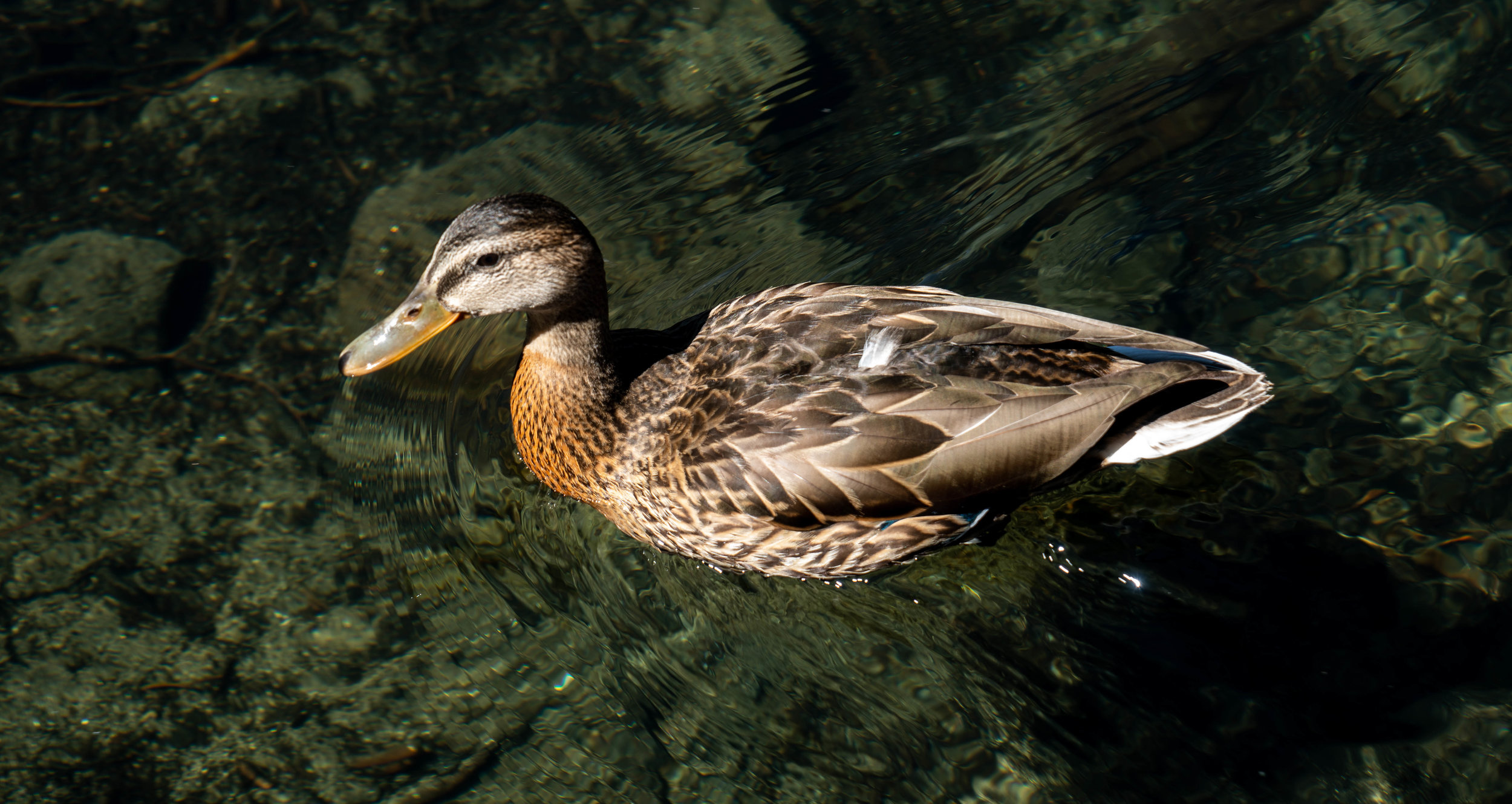
As we arrived, a group was leaving saying they saw a bear on the opposite side of lake and he jumped in to cool off. They showed us the trail they took so we wandered around the lake and kept our eyes open for the bear across the lake. Unfortunately, we weren’t lucky enough to see the bear but we did have some nice views!

We made some friends too!
After about 15-20 mins sitting on a rock in the serene lake, we decided to head back.
More info:
https://www.alltrails.com/explore/trail/us/california/eagle-lake-trail
Related Post: Guide to Lake Tahoe Summer Weekend Getaway - Everything you need to know about Tahoe!
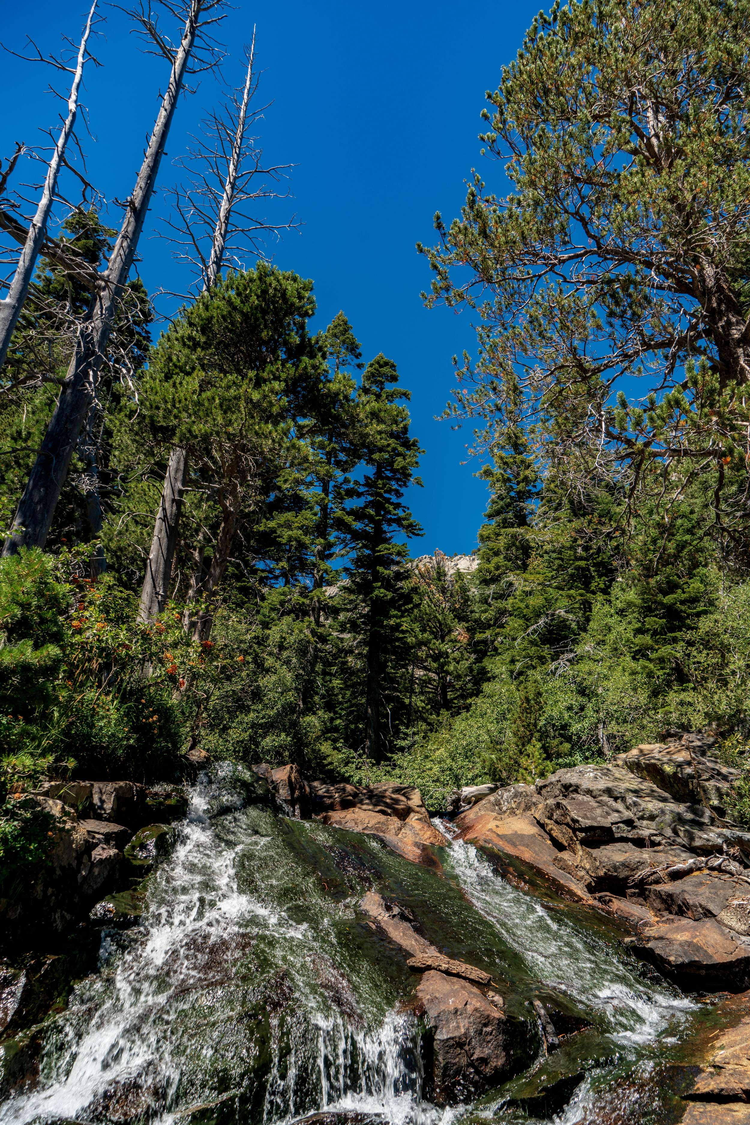
Cascade Falls Trail
Distance: 1.4 miles (round trip)
Elevation Gain: 236 Feet
Time: 1.5-2 hours leaving plenty of time to enjoy the falls and the view
Parking: There is a very small parking lot off the trailhead but it fills up quickly! You’re better off parking along the road as soon as you see the sign. Try to get there before 10a for a good spot! Unless you’re the Mystery Machine! ——>

The Mystery Machine spotted in Lake Tahoe
We parked fairly close to the spot we did the day before for the Eagle Lake Trail. There was a parking area through the campsite but there were limited spots available so we parked on the side of the road.

Cascade Falls Trail Views
The trail starts fairly easy, walking among the trees on flat ground until you hit the trail along the mountain which is fairly rocky, make sure you watch your step!


Rocky trail along Cascade Falls Trail
Once you make it through the trail, you’ll find the falls and beautiful views!

Cascade Falls Views

Cascade Falls
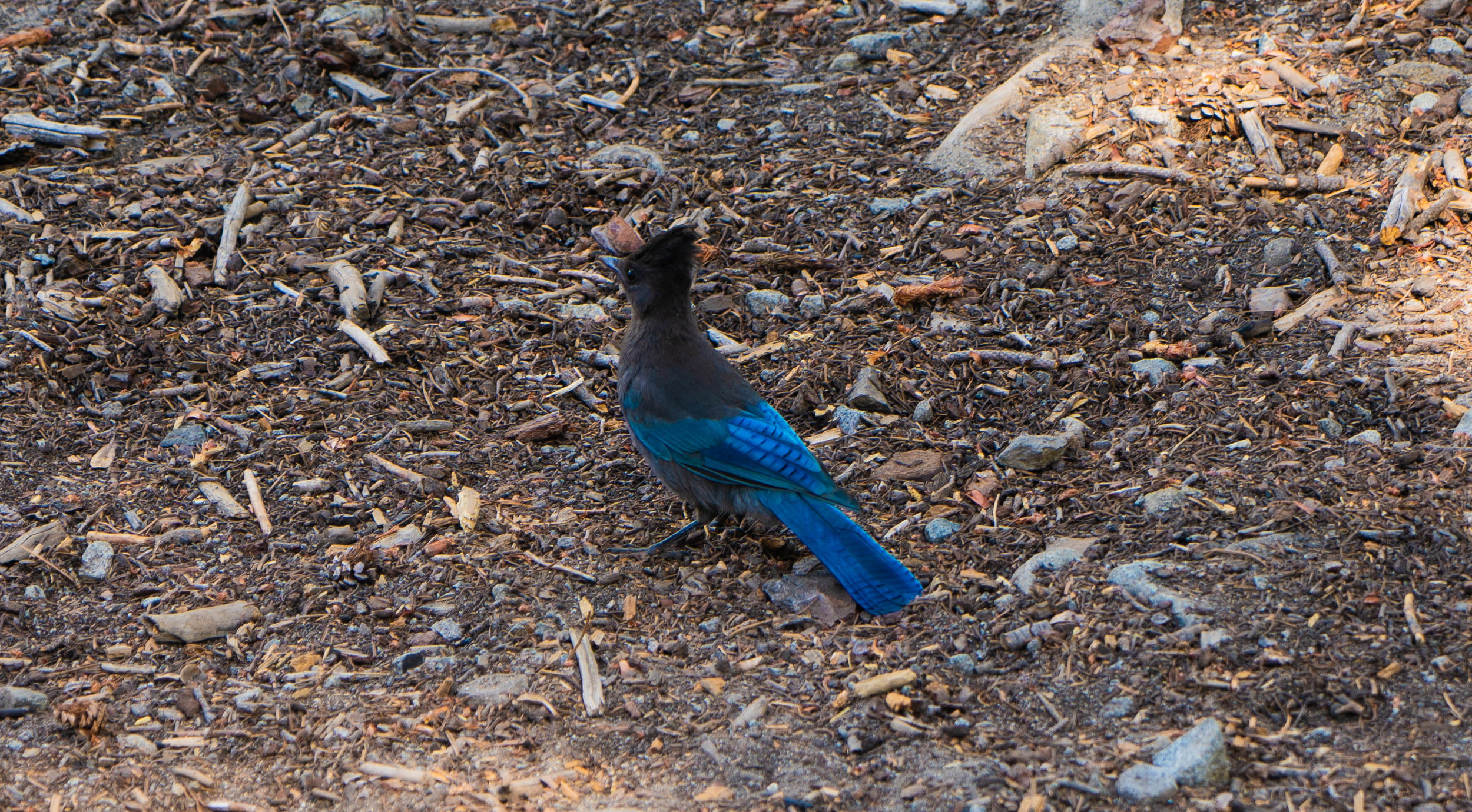
Of course we found more friends!

Chipmunks!

Do you see the lizard?
More information:
https://www.alltrails.com/explore/trail/us/california/cascade-falls
If you liked this post please share it on your favorite social media site using the Share button below because we’d love to get the word out! Feel free to pin this to your favorite Pinterest board:


See more of Sunny California:
Related Post: Guide to Lake Tahoe Summer Weekend Getaway - Everything you need to know about Tahoe!


Looking for the best beaches in Maui for kids? Discover calm, shallow beaches with easy parking, bathrooms, and toddler-friendly waves.